- Home
- County maps
U.S. County Map
Every county and county-equivalent in the United States: 3,144 of them, drawn from Census boundaries. County names cannot fit on one page, so this map shows county lines and state names; each state's own map has every name.
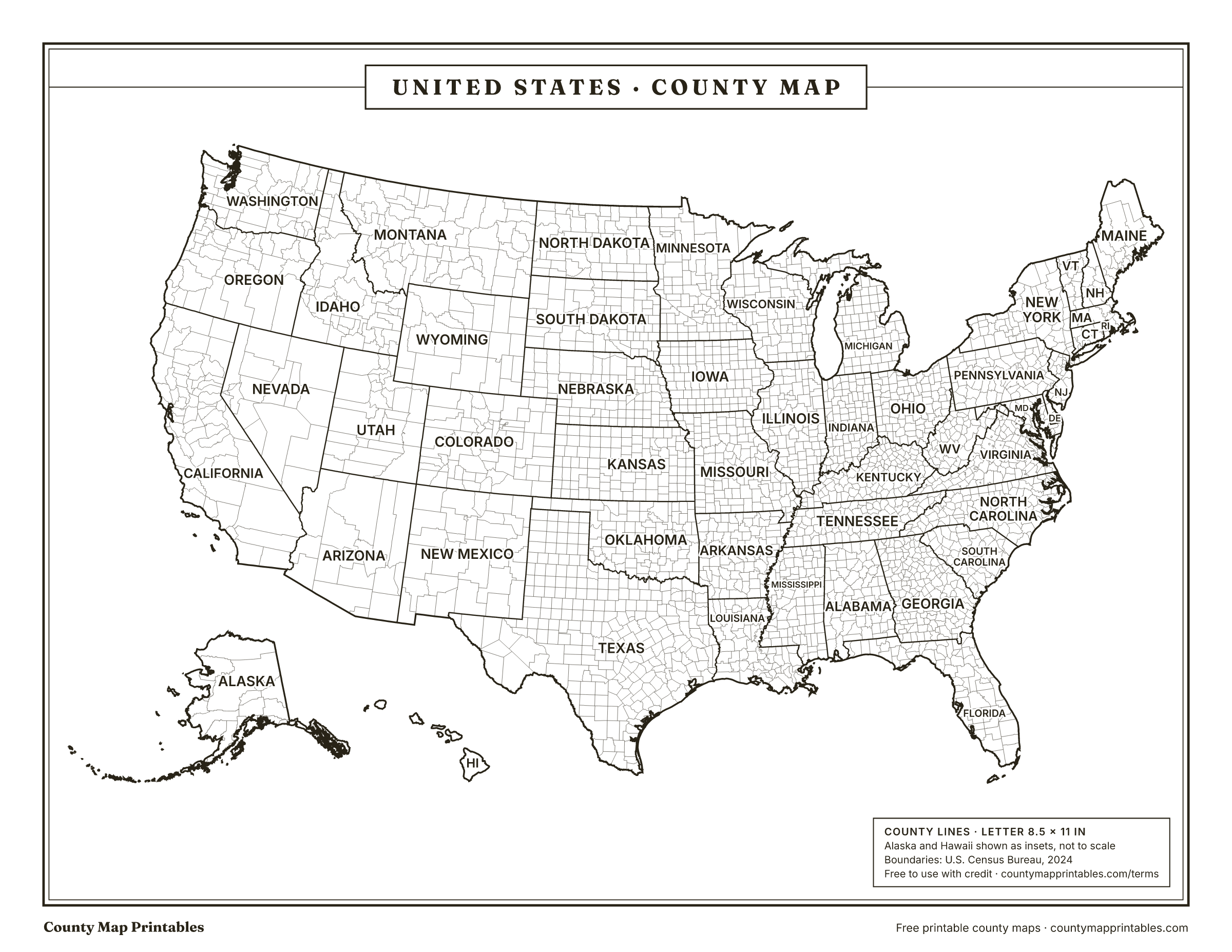
Free to use with credit · Licence
How many counties are in the United States?
There are 3,144 counties and county-equivalents in the United States (the 50 states and the District of Columbia). 2,999 of them are called counties; the other 145 are Louisiana's parishes, Alaska's boroughs and census areas, Connecticut's planning regions, independent cities such as those in Virginia, and the District of Columbia.
The Census Bureau calls all of these “county-equivalents”. The total changed in 2022, when Connecticut's 8 counties were replaced by 9 planning regions for statistical purposes.
The biggest and smallest counties
- Largest by land area
- Yukon-Koyukuk Census AreaAlaska · 145,769 sq mi
- Largest in the contiguous U.S.
- San Bernardino CountyCalifornia · 20,068 sq mi
- Smallest by land area
- Falls Church cityVirginia · 2.0 sq mi
County maps by state
- California58 counties
- Florida67 counties
- Kentucky120 counties
- Michigan83 counties
- New Jersey21 counties
- North Carolina100 counties
- Ohio88 counties
- Pennsylvania67 counties
- Texas254 counties
- Wisconsin72 counties
More states are being added. The table below lists the county count for all 50.
Counties per state
| Called | |||
|---|---|---|---|
| Texas | 254 | Counties | 261,259 |
| Georgia | 159 | Counties | 57,717 |
| Virginia | 133 | Counties | 39,481 |
| Kentucky | 120 | Counties | 39,486 |
| Missouri | 115 | Counties | 68,747 |
| Kansas | 105 | Counties | 81,759 |
| Illinois | 102 | Counties | 55,513 |
| North Carolina | 100 | Counties | 48,624 |
| Iowa | 99 | Counties | 55,854 |
| Tennessee | 95 | Counties | 41,225 |
| Nebraska | 93 | Counties | 76,815 |
| Indiana | 92 | Counties | 35,825 |
| Ohio | 88 | Counties | 40,858 |
| Minnesota | 87 | Counties | 79,632 |
| Michigan | 83 | Counties | 56,611 |
| Mississippi | 82 | Counties | 46,925 |
| Oklahoma | 77 | Counties | 68,597 |
| Arkansas | 75 | Counties | 51,992 |
| Wisconsin | 72 | Counties | 54,168 |
| Alabama | 67 | Counties | 50,651 |
| Florida | 67 | Counties | 53,655 |
| Pennsylvania | 67 | Counties | 44,742 |
| South Dakota | 66 | Counties | 75,808 |
| Colorado | 64 | Counties | 103,637 |
| Louisiana | 64 | Parishes | 43,213 |
| New York | 62 | Counties | 47,124 |
| California | 58 | Counties | 155,860 |
| Montana | 56 | Counties | 145,551 |
| West Virginia | 55 | Counties | 24,041 |
| North Dakota | 53 | Counties | 68,994 |
| South Carolina | 46 | Counties | 30,065 |
| Idaho | 44 | Counties | 82,645 |
| Washington | 39 | Counties | 66,455 |
| Oregon | 36 | Counties | 95,996 |
| New Mexico | 33 | Counties | 121,313 |
| Alaska | 30 | Boroughs and Census Areas | 571,242 |
| Utah | 29 | Counties | 82,596 |
| Maryland | 24 | Counties | 9,711 |
| Wyoming | 23 | Counties | 97,089 |
| New Jersey | 21 | Counties | 7,355 |
| Nevada | 17 | Counties | 109,861 |
| Maine | 16 | Counties | 30,845 |
| Arizona | 15 | Counties | 113,656 |
| Massachusetts | 14 | Counties | 7,801 |
| Vermont | 14 | Counties | 9,217 |
| New Hampshire | 10 | Counties | 8,954 |
| Connecticut | 9 | Counties | 4,843 |
| Hawaii | 5 | Counties | 6,423 |
| Rhode Island | 5 | Counties | 1,034 |
| Delaware | 3 | Counties | 1,949 |
District of Columbia
Washington, D.C. is not in any state and has no counties. The Census Bureau treats the whole District as a single county-equivalent: 61.1 square miles of land and about 702,250 people (2024 estimate).
Boundaries: U.S. Census Bureau cartographic boundary files, 2024. Areas: Census Gazetteer. How these maps are made.