- Home
- County maps
- Pennsylvania
Pennsylvania County Map
Pennsylvania has 67 counties. Lycoming is the largest by land area, Montour the smallest, and Philadelphia the most populous. Print this Pennsylvania (PA) county map blank or labeled, or look up any county by name below.
Map of Pennsylvania counties
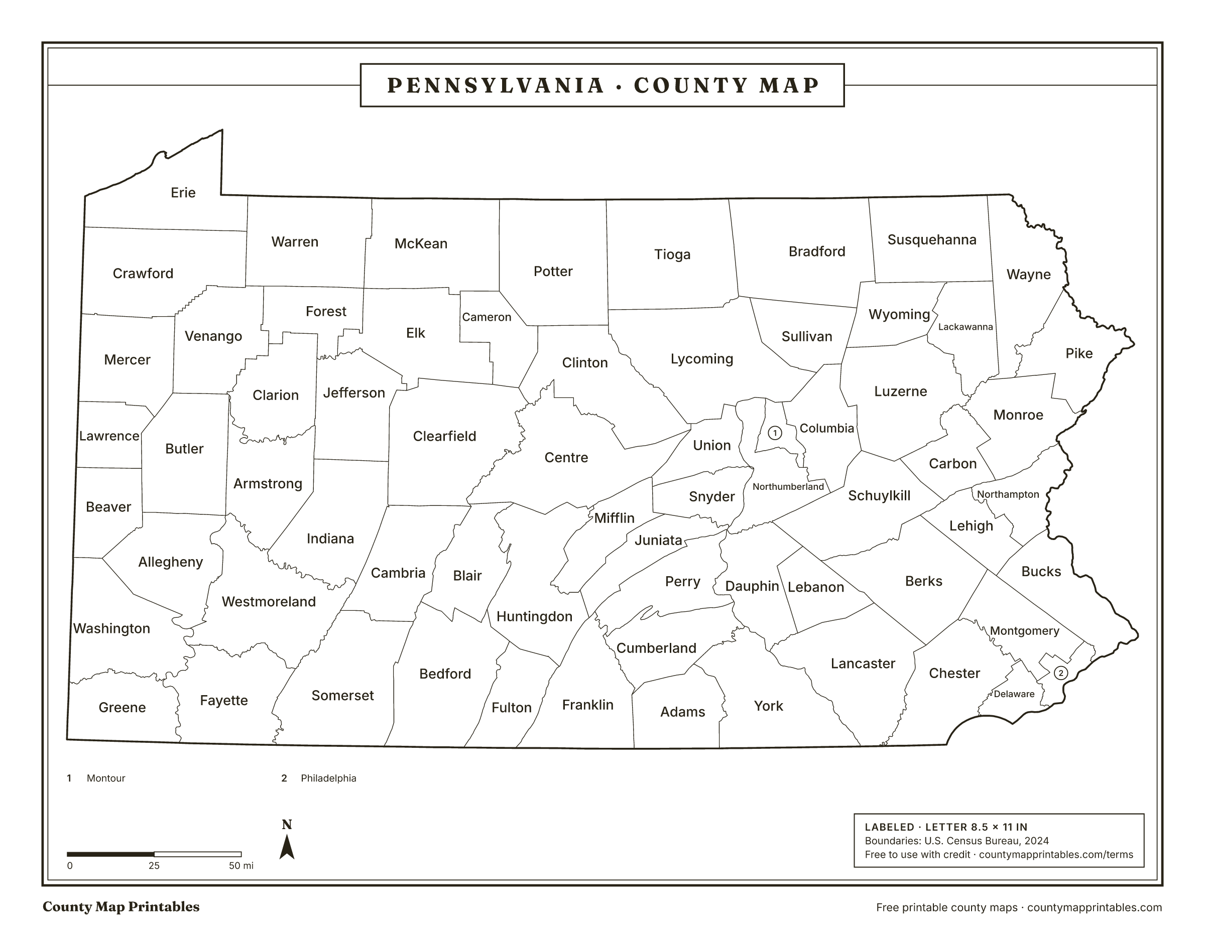
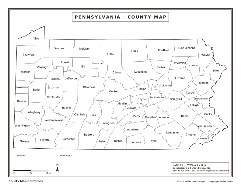
Free to use with credit · Licence
Pennsylvania counties at a glance
- counties
- 67
- Largest by area
- Lycoming1,229 sq mi
- Smallest by area
- Montour130 sq mi
- Most populous
- Philadelphia1,573,916
- Least populous
- Cameron4,348
- Total land area
- 44,742sq mi
Download every version
 Blank
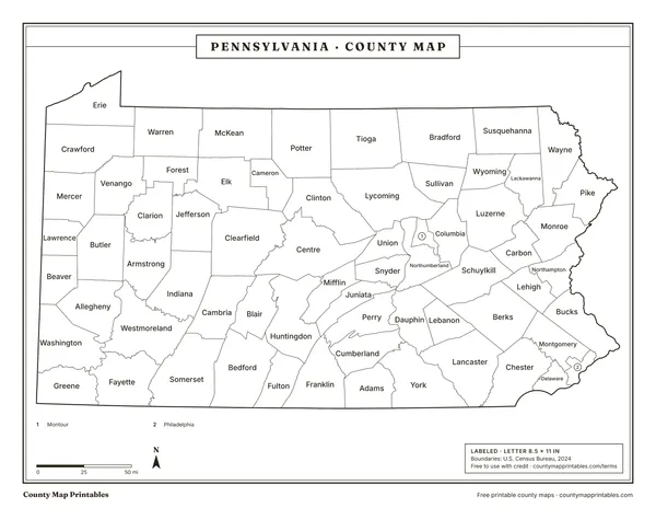 Labeled
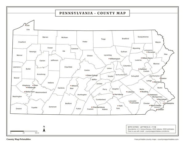 With cities
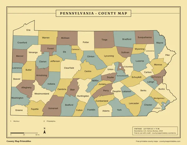 Vintage
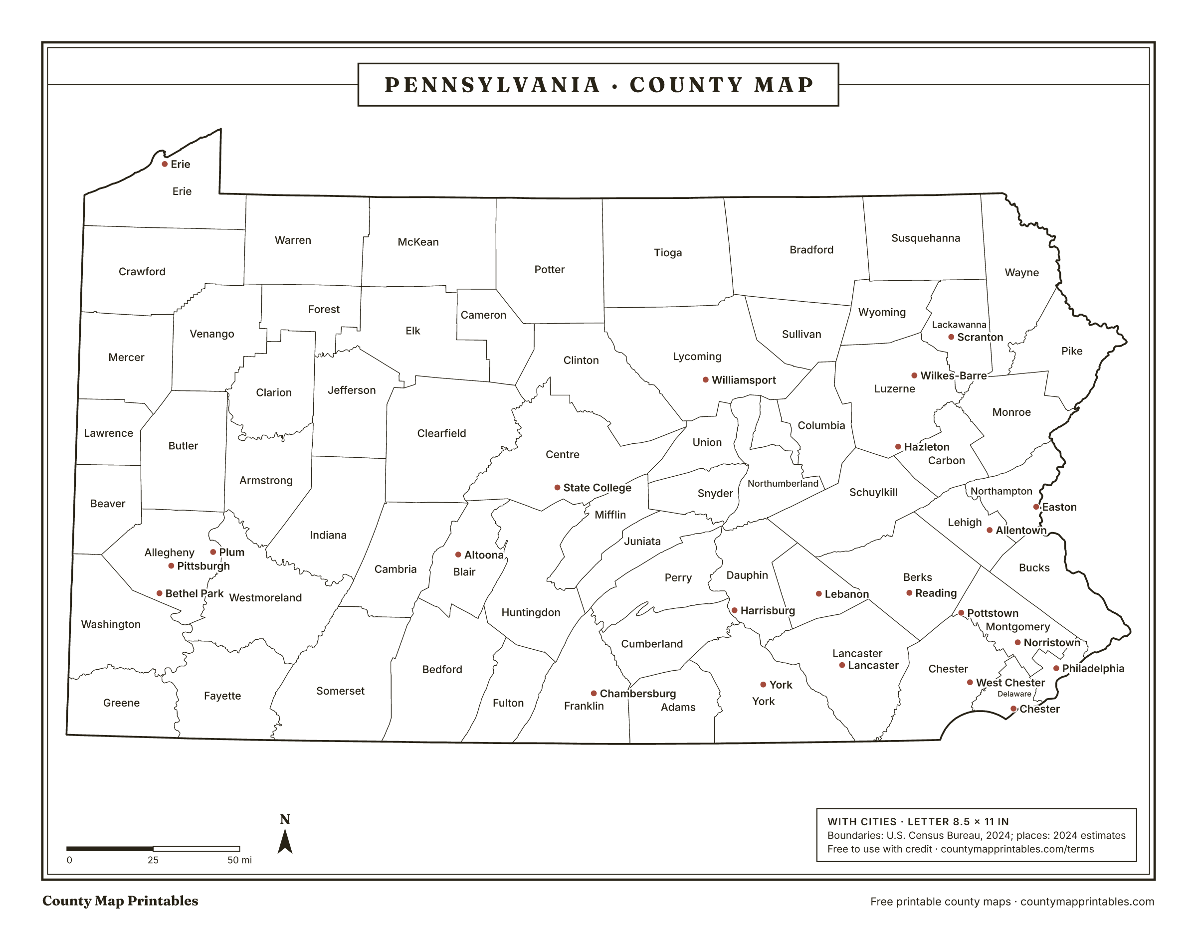
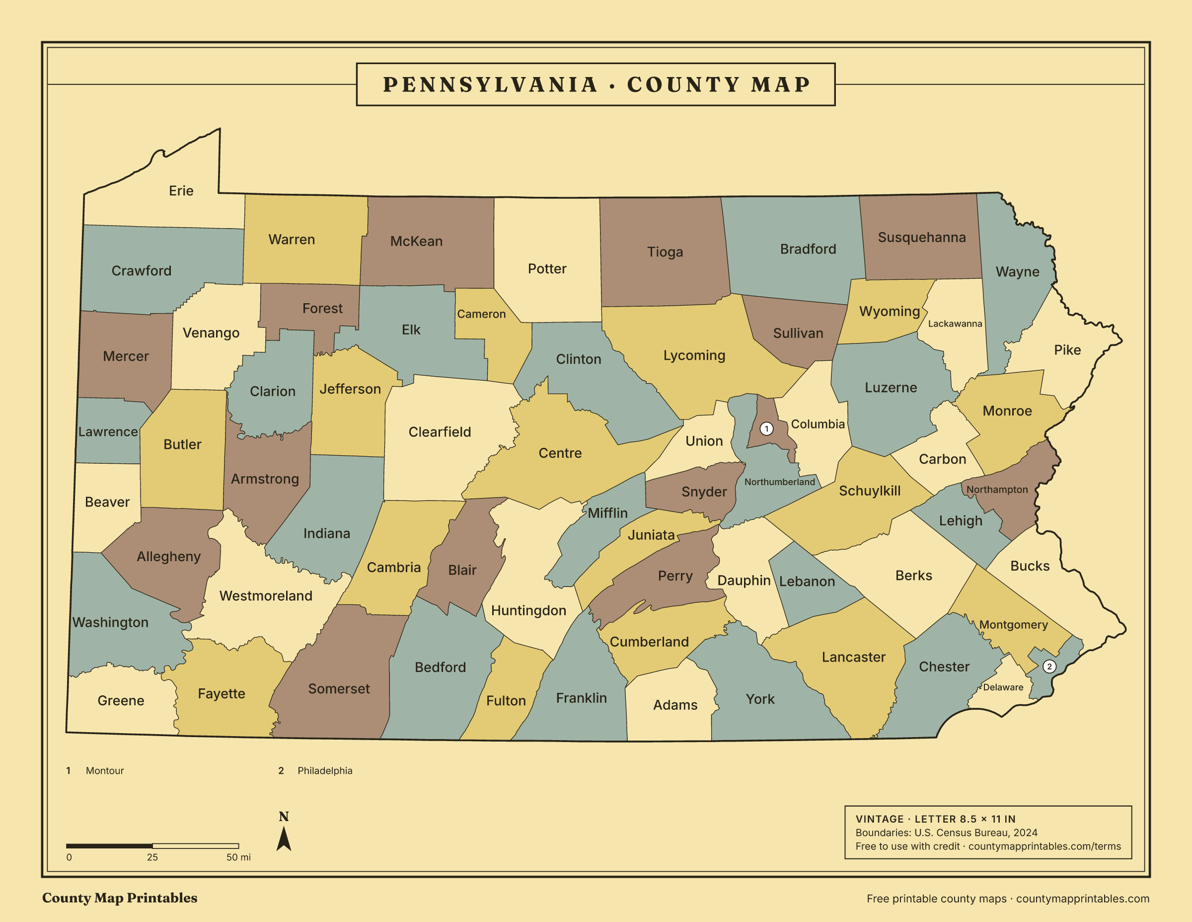
Name, FIPS, land area (sq mi, km²), population, vintage · all 67 rows
List of counties in Pennsylvania
| Borders | ||||
|---|---|---|---|---|
| Philadelphia County | 42101 | 134 | 1,573,916 | Bucks, Burlington, NJ, Camden, NJ, Delaware, Gloucester, NJ, Montgomery |
| Allegheny County | 42003 | 730 | 1,231,814 | Armstrong, Beaver, Butler, Washington, Westmoreland |
| Montgomery County | 42091 | 483 | 879,190 | Berks, Bucks, Chester, Delaware, Lehigh, Philadelphia |
| Bucks County | 42017 | 604 | 650,131 | Burlington, NJ, Hunterdon, NJ, Lehigh, Mercer, NJ, Montgomery, Northampton, Philadelphia, Warren, NJ |
| Delaware County | 42045 | 184 | 584,882 | Chester, Gloucester, NJ, Montgomery, New Castle, DE, Philadelphia |
| Lancaster County | 42071 | 944 | 563,293 | Berks, Cecil, MD, Chester, Dauphin, Harford, MD, Lebanon, York |
| Chester County | 42029 | 751 | 560,745 | Berks, Cecil, MD, Delaware, Lancaster, Montgomery, New Castle, DE |
| York County | 42133 | 904 | 471,240 | Adams, Baltimore, MD, Carroll, MD, Cumberland, Dauphin, Harford, MD, Lancaster |
| Berks County | 42011 | 856 | 439,117 | Chester, Lancaster, Lebanon, Lehigh, Montgomery, Schuylkill |
| Lehigh County | 42077 | 345 | 385,655 | Berks, Bucks, Carbon, Montgomery, Northampton, Schuylkill |
| Westmoreland County | 42129 | 1,028 | 350,935 | Allegheny, Armstrong, Cambria, Fayette, Indiana, Somerset, Washington |
| Luzerne County | 42079 | 890 | 331,379 | Carbon, Columbia, Lackawanna, Monroe, Schuylkill, Sullivan, Wyoming |
| Northampton County | 42095 | 370 | 322,989 | Bucks, Carbon, Lehigh, Monroe, Warren, NJ |
| Dauphin County | 42043 | 525 | 293,029 | Cumberland, Juniata, Lancaster, Lebanon, Northumberland, Perry, Schuylkill, York |
| Cumberland County | 42041 | 546 | 275,516 | Adams, Dauphin, Franklin, Perry, York |
| Erie County | 42049 | 799 | 267,750 | Ashtabula, OH, Chautauqua, NY, Crawford, Warren |
| Lackawanna County | 42069 | 459 | 216,859 | Luzerne, Monroe, Susquehanna, Wayne, Wyoming |
| Washington County | 42125 | 857 | 210,434 | Allegheny, Beaver, Brooke, WV, Fayette, Greene, Hancock, WV, Marshall, WV, Ohio, WV, Westmoreland |
| Butler County | 42019 | 790 | 199,341 | Allegheny, Armstrong, Beaver, Clarion, Lawrence, Mercer, Venango |
| Monroe County | 42089 | 608 | 166,523 | Carbon, Lackawanna, Luzerne, Northampton, Pike, Sussex, NJ, Warren, NJ, Wayne |
| Beaver County | 42007 | 435 | 165,540 | Allegheny, Butler, Columbiana, OH, Hancock, WV, Lawrence, Washington |
| Centre County | 42027 | 1,107 | 159,805 | Blair, Clearfield, Clinton, Huntingdon, Mifflin, Union |
| Franklin County | 42055 | 772 | 159,285 | Adams, Cumberland, Frederick, MD, Fulton, Huntingdon, Juniata, Perry, Washington, MD |
| Lebanon County | 42075 | 362 | 145,319 | Berks, Dauphin, Lancaster, Schuylkill |
| Schuylkill County | 42107 | 779 | 144,523 | Berks, Carbon, Columbia, Dauphin, Lebanon, Lehigh, Luzerne, Northumberland |
| Cambria County | 42021 | 688 | 130,108 | Bedford, Blair, Clearfield, Indiana, Somerset, Westmoreland |
| Fayette County | 42051 | 791 | 123,941 | Garrett, MD, Greene, Monongalia, WV, Preston, WV, Somerset, Washington, Westmoreland |
| Blair County | 42013 | 525 | 120,269 | Bedford, Cambria, Centre, Clearfield, Huntingdon |
| Lycoming County | 42081 | 1,229 | 113,236 | Bradford, Clinton, Columbia, Montour, Northumberland, Potter, Sullivan, Tioga, Union |
| Mercer County | 42085 | 673 | 108,140 | Butler, Crawford, Lawrence, Mahoning, OH, Trumbull, OH, Venango |
| Adams County | 42001 | 519 | 107,914 | Carroll, MD, Cumberland, Franklin, Frederick, MD, York |
| Northumberland County | 42097 | 458 | 90,027 | Columbia, Dauphin, Juniata, Lycoming, Montour, Perry, Schuylkill, Snyder, Union |
| Lawrence County | 42073 | 357 | 84,233 | Beaver, Butler, Columbiana, OH, Mahoning, OH, Mercer |
| Indiana County | 42063 | 827 | 82,953 | Armstrong, Cambria, Clearfield, Jefferson, Westmoreland |
| Crawford County | 42039 | 1,012 | 82,089 | Ashtabula, OH, Erie, Mercer, Trumbull, OH, Venango, Warren |
| Clearfield County | 42033 | 1,145 | 78,132 | Blair, Cambria, Cameron, Centre, Clinton, Elk, Indiana, Jefferson |
| Somerset County | 42111 | 1,075 | 72,134 | Allegany, MD, Bedford, Cambria, Fayette, Garrett, MD, Westmoreland |
| Columbia County | 42037 | 483 | 66,012 | Luzerne, Lycoming, Montour, Northumberland, Schuylkill, Sullivan |
| Carbon County | 42025 | 381 | 65,743 | Lehigh, Luzerne, Monroe, Northampton, Schuylkill |
| Armstrong County | 42005 | 653 | 63,679 | Allegheny, Butler, Clarion, Indiana, Jefferson, Westmoreland |
| Pike County | 42103 | 545 | 62,376 | Monroe, Orange, NY, Sullivan, NY, Sussex, NJ, Wayne |
| Bradford County | 42015 | 1,147 | 59,699 | Chemung, NY, Lycoming, Sullivan, Susquehanna, Tioga, NY, Tioga, Wyoming |
| Wayne County | 42127 | 726 | 51,419 | Broome, NY, Delaware, NY, Lackawanna, Monroe, Pike, Sullivan, NY, Susquehanna |
| Venango County | 42121 | 674 | 49,476 | Butler, Clarion, Crawford, Forest, Mercer, Warren |
| Bedford County | 42009 | 1,012 | 47,643 | Allegany, MD, Blair, Cambria, Fulton, Huntingdon, Somerset |
| Perry County | 42099 | 551 | 46,816 | Cumberland, Dauphin, Franklin, Juniata, Northumberland |
| Mifflin County | 42087 | 411 | 45,935 | Centre, Huntingdon, Juniata, Snyder, Union |
| Jefferson County | 42065 | 652 | 43,367 | Armstrong, Clarion, Clearfield, Elk, Forest, Indiana |
| Huntingdon County | 42061 | 875 | 43,359 | Bedford, Blair, Centre, Franklin, Fulton, Juniata, Mifflin |
| Union County | 42119 | 316 | 42,159 | Centre, Clinton, Lycoming, Mifflin, Northumberland, Snyder |
| Tioga County | 42117 | 1,134 | 40,698 | Bradford, Chemung, NY, Lycoming, Potter, Steuben, NY |
| Snyder County | 42109 | 329 | 39,627 | Juniata, Mifflin, Northumberland, Union |
| McKean County | 42083 | 980 | 39,478 | Allegany, NY, Cameron, Cattaraugus, NY, Elk, Potter, Warren |
| Susquehanna County | 42115 | 824 | 38,100 | Bradford, Broome, NY, Lackawanna, Tioga, NY, Wayne, Wyoming |
| Clinton County | 42035 | 890 | 37,865 | Cameron, Centre, Clearfield, Lycoming, Potter, Union |
| Warren County | 42123 | 884 | 37,373 | Cattaraugus, NY, Chautauqua, NY, Crawford, Elk, Erie, Forest, McKean, Venango |
| Clarion County | 42031 | 601 | 36,855 | Armstrong, Butler, Forest, Jefferson, Venango |
| Greene County | 42059 | 576 | 33,960 | Fayette, Marshall, WV, Monongalia, WV, Washington, Wetzel, WV |
| Elk County | 42047 | 827 | 30,124 | Cameron, Clearfield, Forest, Jefferson, McKean, Warren |
| Wyoming County | 42131 | 397 | 25,771 | Bradford, Lackawanna, Luzerne, Sullivan, Susquehanna |
| Juniata County | 42067 | 391 | 23,395 | Dauphin, Franklin, Huntingdon, Mifflin, Northumberland, Perry, Snyder |
| Montour County | 42093 | 130 | 18,115 | Columbia, Lycoming, Northumberland |
| Potter County | 42105 | 1,081 | 15,993 | Allegany, NY, Cameron, Clinton, Lycoming, McKean, Steuben, NY, Tioga |
| Fulton County | 42057 | 438 | 14,452 | Allegany, MD, Bedford, Franklin, Huntingdon, Washington, MD |
| Forest County | 42053 | 427 | 6,601 | Clarion, Elk, Jefferson, Venango, Warren |
| Sullivan County | 42113 | 450 | 5,927 | Bradford, Columbia, Luzerne, Lycoming, Wyoming |
| Cameron County | 42023 | 396 | 4,348 | Clearfield, Clinton, Elk, McKean, Potter |
Hover a row to find the county on the map. Areas: Census Gazetteer 2024. Population: Census Bureau estimates for July 1, 2024.
How many counties are in Pennsylvania?
Pennsylvania has 67 counties.
About Pennsylvania's counties
- Philadelphia is a consolidated city and county: the city and Philadelphia County share one boundary and one government.
- The most populous is Philadelphia County, with about 1,573,916 people; the least populous is Cameron County, with 4,348.
Sources: U.S. Census Bureau. Last checked 2026-11-18.
Neighbouring states
- Delaware3 counties
- Maryland24 counties
- New Jersey21 counties
- New York62 counties
- Ohio88 counties
- West Virginia55 counties
Questions
What is the largest county in Pennsylvania?
Lycoming County, with 1,229 square miles of land.
What is the smallest county in Pennsylvania?
Montour County, with 130 square miles of land.
Which county in Pennsylvania has the most people?
Philadelphia County, with an estimated 1,573,916 people (2024).
Which county is Philadelphia in?
Philadelphia, the largest city in Pennsylvania, is in Philadelphia County. Large cities can spill into neighbouring counties; Philadelphia County holds the city's Census internal point.
Can I use these maps in class or at work?
Yes. Print, copy and use them in lessons, reports and slides, with the credit “Map: countymapprintables.com”. Keeping the footer on the file counts as the credit.
Boundaries: U.S. Census Bureau cartographic boundary files, 2024 (1:500,000). County facts: Census Gazetteer and county population estimates. How these maps are made.