- Home
- County maps
- Kentucky
Kentucky County Map
Kentucky has 120 counties. Pike is the largest by land area, Gallatin the smallest, and Jefferson the most populous. Print this Kentucky (KY) county map blank or labeled, or look up any county by name below.
Map of Kentucky counties
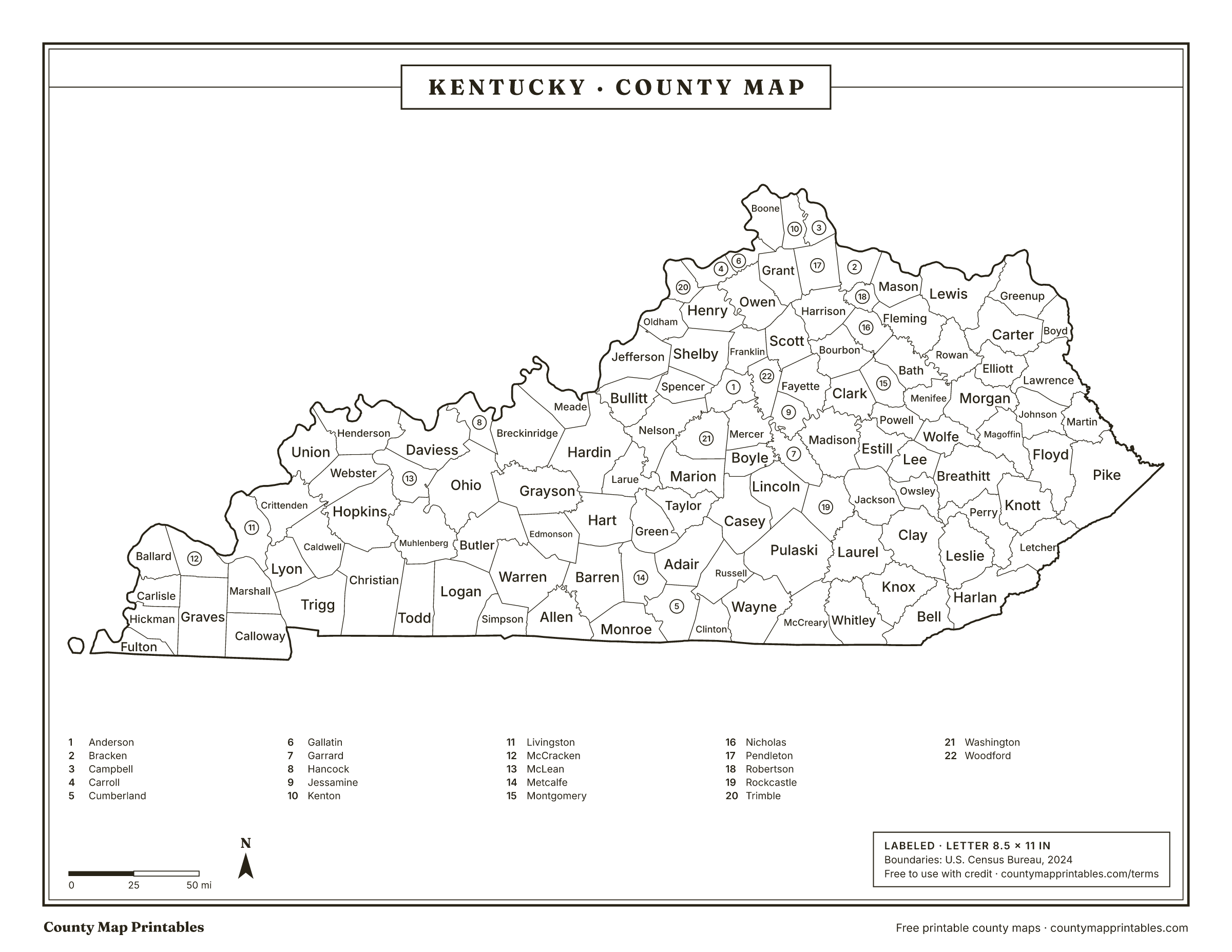
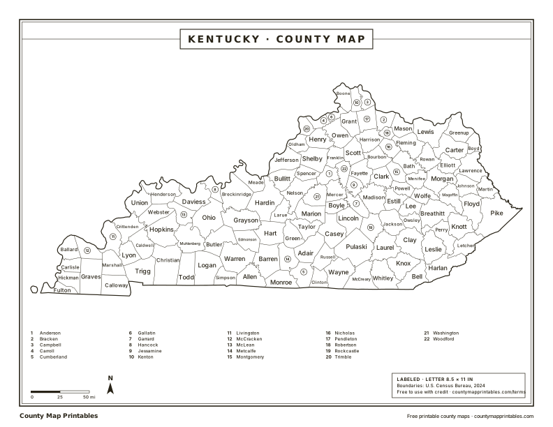
Free to use with credit · Licence
Kentucky counties at a glance
Download every version
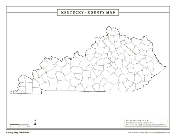 BlankTabloid 11×17 PDF
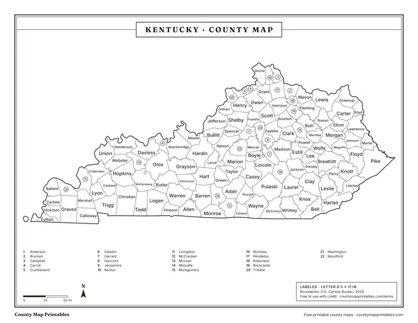 LabeledTabloid 11×17 PDF
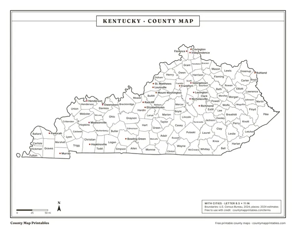 With citiesTabloid 11×17 PDF
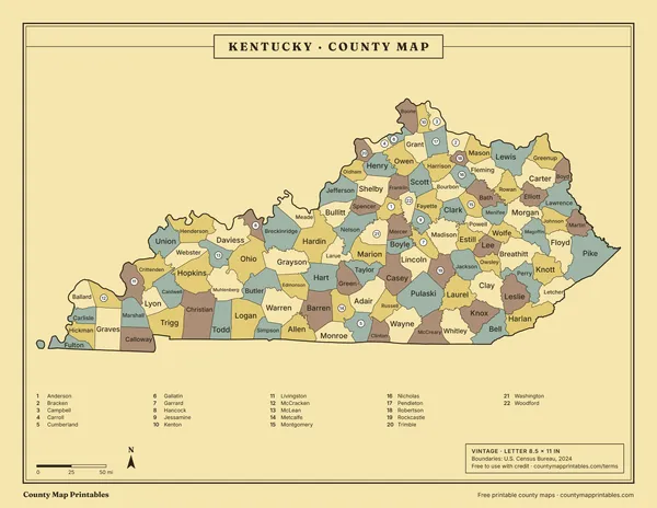 VintageTabloid 11×17 PDF
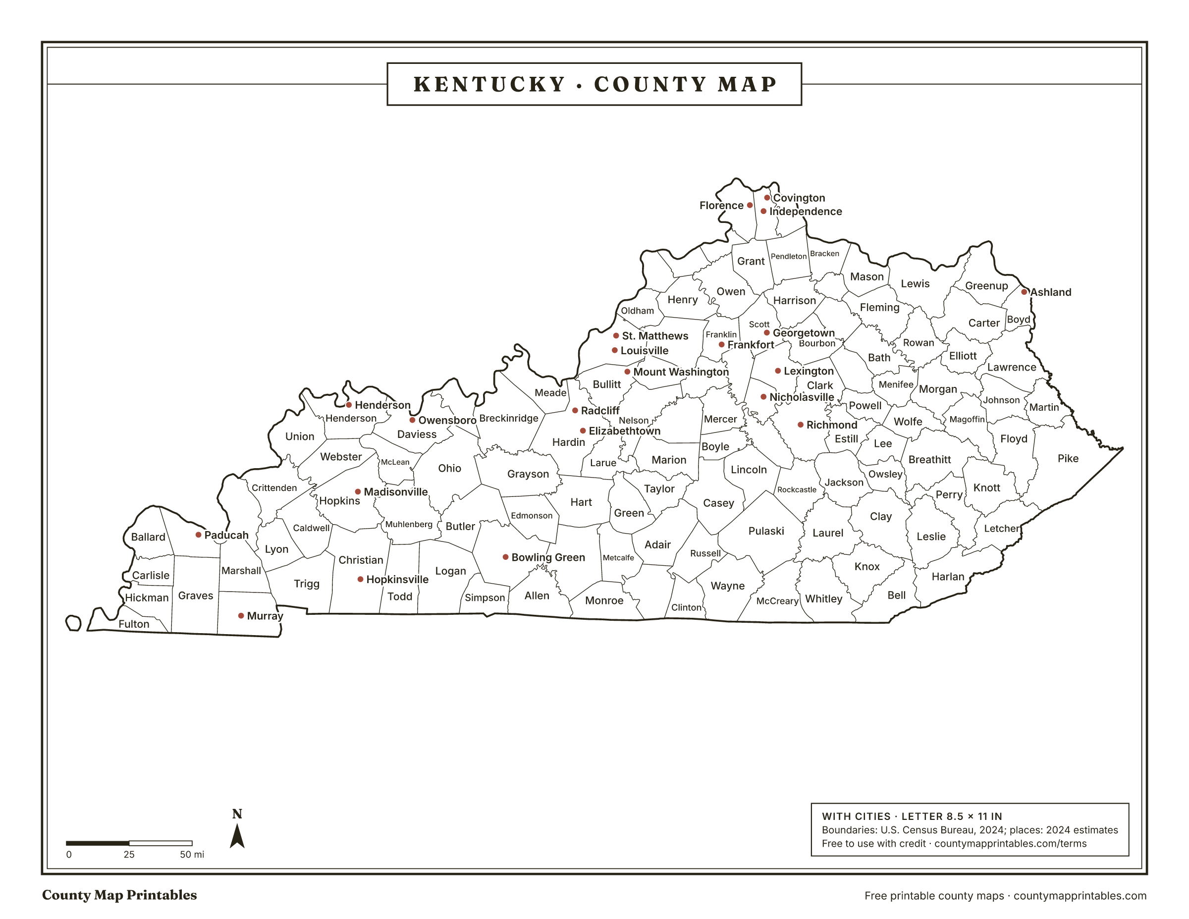
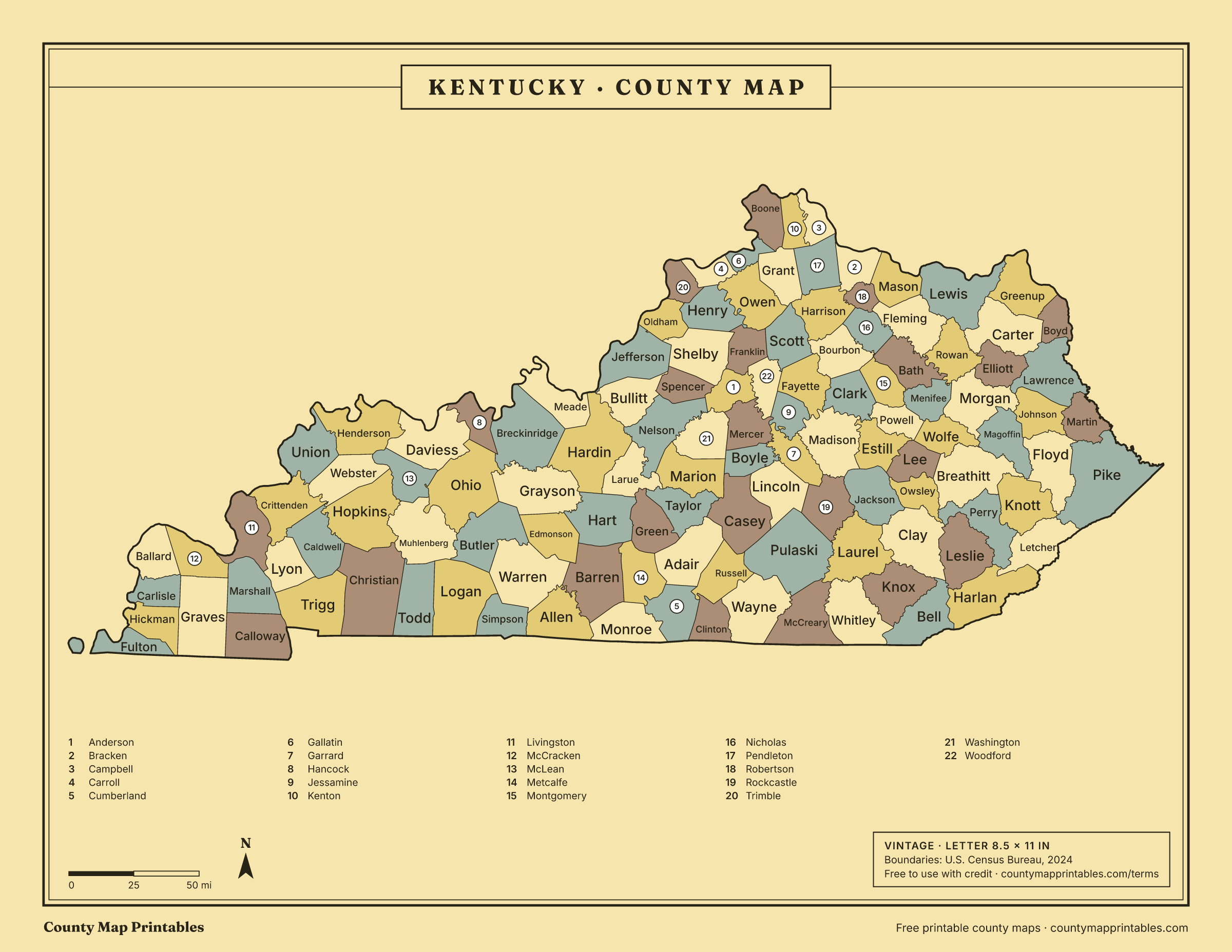
Name, FIPS, land area (sq mi, km²), population, vintage · all 120 rows
List of counties in Kentucky
| Borders | ||||
|---|---|---|---|---|
| Jefferson County | 21111 | 381 | 793,881 | Bullitt, Clark, IN, Floyd, IN, Hardin, Harrison, IN, Oldham, Shelby, Spencer |
| Fayette County | 21067 | 284 | 329,437 | Bourbon, Clark, Jessamine, Madison, Scott, Woodford |
| Kenton County | 21117 | 160 | 174,862 | Boone, Campbell, Grant, Hamilton, OH, Pendleton |
| Warren County | 21227 | 542 | 147,936 | Allen, Barren, Butler, Edmonson, Logan, Simpson |
| Boone County | 21015 | 246 | 144,135 | Dearborn, IN, Gallatin, Grant, Hamilton, OH, Kenton, Ohio, IN, Switzerland, IN |
| Hardin County | 21093 | 624 | 112,826 | Breckinridge, Bullitt, Grayson, Harrison, IN, Hart, Jefferson, Larue, Meade, Nelson |
| Daviess County | 21059 | 458 | 104,457 | Hancock, Henderson, McLean, Ohio, Spencer, IN, Warrick, IN |
| Madison County | 21151 | 438 | 99,582 | Clark, Estill, Fayette, Garrard, Jackson, Jessamine, Rockcastle |
| Campbell County | 21037 | 151 | 94,008 | Clermont, OH, Hamilton, OH, Kenton, Pendleton |
| Bullitt County | 21029 | 297 | 85,802 | Hardin, Jefferson, Nelson, Spencer |
| Christian County | 21047 | 718 | 71,006 | Caldwell, Hopkins, Montgomery, TN, Muhlenberg, Stewart, TN, Todd, Trigg |
| Oldham County | 21185 | 187 | 70,525 | Clark, IN, Henry, Jefferson, Shelby, Trimble |
| McCracken County | 21145 | 249 | 67,550 | Ballard, Carlisle, Graves, Livingston, Marshall, Massac, IL, Pulaski, IL |
| Pulaski County | 21199 | 658 | 66,842 | Casey, Laurel, Lincoln, McCreary, Rockcastle, Russell, Wayne |
| Laurel County | 21125 | 434 | 63,353 | Clay, Jackson, Knox, McCreary, Pulaski, Rockcastle, Whitley |
| Scott County | 21209 | 282 | 61,700 | Bourbon, Fayette, Franklin, Grant, Harrison, Owen, Woodford |
| Jessamine County | 21113 | 172 | 56,495 | Fayette, Garrard, Madison, Mercer, Woodford |
| Pike County | 21195 | 786 | 55,430 | Buchanan, VA, Dickenson, VA, Floyd, Knott, Letcher, Martin, Mingo, WV, Wise, VA |
| Franklin County | 21073 | 208 | 52,442 | Anderson, Henry, Owen, Scott, Shelby, Woodford |
| Shelby County | 21211 | 380 | 50,124 | Anderson, Franklin, Henry, Jefferson, Oldham, Spencer |
| Nelson County | 21179 | 419 | 48,706 | Anderson, Bullitt, Hardin, Larue, Marion, Spencer, Washington |
| Boyd County | 21019 | 160 | 47,777 | Carter, Greenup, Lawrence, Lawrence, OH, Wayne, WV |
| Barren County | 21009 | 487 | 45,609 | Allen, Edmonson, Hart, Metcalfe, Monroe, Warren |
| Hopkins County | 21107 | 542 | 45,218 | Caldwell, Christian, McLean, Muhlenberg, Webster |
| Henderson County | 21101 | 436 | 44,175 | Daviess, McLean, Posey, IN, Union, Vanderburgh, IN, Warrick, IN, Webster |
| Calloway County | 21035 | 385 | 38,975 | Graves, Henry, TN, Marshall, Stewart, TN, Trigg |
| Clark County | 21049 | 253 | 37,673 | Bourbon, Estill, Fayette, Madison, Montgomery, Powell |
| Whitley County | 21235 | 438 | 37,233 | Bell, Campbell, TN, Claiborne, TN, Knox, Laurel, McCreary |
| Graves County | 21083 | 552 | 36,821 | Calloway, Carlisle, Henry, TN, Hickman, Marshall, McCracken, Weakley, TN |
| Greenup County | 21089 | 345 | 35,273 | Boyd, Carter, Lawrence, OH, Lewis, Scioto, OH |
| Floyd County | 21071 | 393 | 34,532 | Johnson, Knott, Magoffin, Martin, Pike |
| Marshall County | 21157 | 302 | 31,734 | Calloway, Graves, Livingston, Lyon, McCracken, Trigg |
| Boyle County | 21021 | 180 | 31,394 | Casey, Garrard, Lincoln, Marion, Mercer, Washington |
| Muhlenberg County | 21177 | 467 | 30,512 | Butler, Christian, Hopkins, Logan, McLean, Ohio, Todd |
| Meade County | 21163 | 306 | 30,442 | Breckinridge, Crawford, IN, Hardin, Harrison, IN, Perry, IN |
| Knox County | 21121 | 386 | 29,657 | Bell, Clay, Laurel, Whitley |
| Montgomery County | 21173 | 197 | 28,771 | Bath, Bourbon, Clark, Menifee, Nicholas, Powell |
| Logan County | 21141 | 552 | 28,467 | Butler, Muhlenberg, Robertson, TN, Simpson, Todd, Warren |
| Woodford County | 21239 | 190 | 27,728 | Anderson, Fayette, Franklin, Jessamine, Mercer, Scott |
| Grayson County | 21085 | 500 | 27,070 | Breckinridge, Butler, Edmonson, Hardin, Hart, Ohio |
| Taylor County | 21217 | 266 | 26,809 | Adair, Casey, Green, Larue, Marion |
| Perry County | 21193 | 340 | 26,739 | Breathitt, Clay, Harlan, Knott, Leslie, Letcher, Owsley |
| Carter County | 21043 | 410 | 26,098 | Boyd, Elliott, Greenup, Lawrence, Lewis, Rowan |
| Grant County | 21081 | 258 | 25,722 | Boone, Gallatin, Harrison, Kenton, Owen, Pendleton, Scott |
| Harlan County | 21095 | 466 | 25,052 | Bell, Lee, VA, Leslie, Letcher, Perry, Wise, VA |
| Lincoln County | 21137 | 333 | 24,910 | Boyle, Casey, Garrard, Pulaski, Rockcastle |
| Anderson County | 21005 | 202 | 24,883 | Franklin, Mercer, Nelson, Shelby, Spencer, Washington, Woodford |
| Rowan County | 21205 | 280 | 24,675 | Bath, Carter, Elliott, Fleming, Lewis, Menifee, Morgan |
| Ohio County | 21183 | 587 | 23,933 | Breckinridge, Butler, Daviess, Grayson, Hancock, McLean, Muhlenberg |
| Mercer County | 21167 | 249 | 23,515 | Anderson, Boyle, Garrard, Jessamine, Washington, Woodford |
| Bell County | 21013 | 359 | 23,051 | Claiborne, TN, Clay, Harlan, Knox, Lee, VA, Leslie, Whitley |
| Johnson County | 21115 | 262 | 22,098 | Floyd, Lawrence, Magoffin, Martin, Morgan |
| Allen County | 21003 | 344 | 22,037 | Barren, Macon, TN, Monroe, Simpson, Sumner, TN, Warren |
| Breckinridge County | 21027 | 570 | 21,221 | Grayson, Hancock, Hardin, Meade, Ohio, Perry, IN |
| Spencer County | 21215 | 187 | 20,823 | Anderson, Bullitt, Jefferson, Nelson, Shelby |
| Simpson County | 21213 | 234 | 20,350 | Allen, Logan, Robertson, TN, Sumner, TN, Warren |
| Bourbon County | 21017 | 290 | 20,333 | Bath, Clark, Fayette, Harrison, Montgomery, Nicholas, Scott |
| Letcher County | 21133 | 338 | 20,139 | Harlan, Knott, Perry, Pike, Wise, VA |
| Hart County | 21099 | 413 | 19,923 | Barren, Edmonson, Grayson, Green, Hardin, Larue, Metcalfe |
| Marion County | 21155 | 344 | 19,851 | Boyle, Casey, Larue, Nelson, Taylor, Washington |
| Wayne County | 21231 | 458 | 19,629 | Clinton, McCreary, Pickett, TN, Pulaski, Russell, Scott, TN |
| Clay County | 21051 | 469 | 19,592 | Bell, Jackson, Knox, Laurel, Leslie, Owsley, Perry |
| Harrison County | 21097 | 307 | 19,525 | Bourbon, Bracken, Grant, Nicholas, Pendleton, Robertson, Scott |
| Adair County | 21001 | 405 | 19,239 | Casey, Cumberland, Green, Metcalfe, Russell, Taylor |
| Russell County | 21207 | 253 | 18,458 | Adair, Casey, Clinton, Cumberland, Pulaski, Wayne |
| Garrard County | 21079 | 230 | 18,040 | Boyle, Jessamine, Lincoln, Madison, Mercer, Rockcastle |
| Mason County | 21161 | 240 | 16,956 | Adams, OH, Bracken, Brown, OH, Fleming, Lewis, Robertson |
| McCreary County | 21147 | 427 | 16,824 | Campbell, TN, Laurel, Pulaski, Scott, TN, Wayne, Whitley |
| Rockcastle County | 21203 | 317 | 16,226 | Garrard, Jackson, Laurel, Lincoln, Madison, Pulaski |
| Henry County | 21103 | 286 | 16,198 | Carroll, Franklin, Oldham, Owen, Shelby, Trimble |
| Casey County | 21045 | 444 | 15,948 | Adair, Boyle, Lincoln, Marion, Pulaski, Russell, Taylor |
| Lawrence County | 21127 | 416 | 15,798 | Boyd, Carter, Elliott, Johnson, Martin, Morgan, Wayne, WV |
| Fleming County | 21069 | 349 | 15,591 | Bath, Lewis, Mason, Nicholas, Robertson, Rowan |
| Larue County | 21123 | 261 | 15,128 | Green, Hardin, Hart, Marion, Nelson, Taylor |
| Pendleton County | 21191 | 277 | 14,844 | Bracken, Campbell, Clermont, OH, Grant, Harrison, Kenton |
| Trigg County | 21221 | 441 | 14,559 | Caldwell, Calloway, Christian, Lyon, Marshall, Stewart, TN |
| Morgan County | 21175 | 381 | 14,300 | Elliott, Johnson, Lawrence, Magoffin, Menifee, Rowan, Wolfe |
| Estill County | 21065 | 253 | 14,002 | Clark, Jackson, Lee, Madison, Powell |
| Knott County | 21119 | 352 | 13,438 | Breathitt, Floyd, Letcher, Magoffin, Perry, Pike |
| Jackson County | 21109 | 345 | 13,358 | Clay, Estill, Laurel, Lee, Madison, Owsley, Rockcastle |
| Union County | 21225 | 343 | 13,178 | Crittenden, Gallatin, IL, Hardin, IL, Henderson, Posey, IN, Webster |
| Bath County | 21011 | 278 | 12,951 | Bourbon, Fleming, Menifee, Montgomery, Nicholas, Rowan |
| Powell County | 21197 | 179 | 12,928 | Clark, Estill, Lee, Menifee, Montgomery, Wolfe |
| Lewis County | 21135 | 483 | 12,875 | Adams, OH, Carter, Fleming, Greenup, Mason, Rowan, Scioto, OH |
| Webster County | 21233 | 332 | 12,854 | Caldwell, Crittenden, Henderson, Hopkins, McLean, Union |
| Breathitt County | 21025 | 492 | 12,804 | Knott, Lee, Magoffin, Owsley, Perry, Wolfe |
| Todd County | 21219 | 375 | 12,757 | Christian, Logan, Montgomery, TN, Muhlenberg, Robertson, TN |
| Edmonson County | 21061 | 303 | 12,635 | Barren, Butler, Grayson, Hart, Warren |
| Caldwell County | 21033 | 345 | 12,611 | Christian, Crittenden, Hopkins, Lyon, Trigg, Webster |
| Butler County | 21031 | 426 | 12,551 | Edmonson, Grayson, Logan, Muhlenberg, Ohio, Warren |
| Washington County | 21229 | 297 | 12,269 | Anderson, Boyle, Marion, Mercer, Nelson |
| Green County | 21087 | 286 | 11,552 | Adair, Hart, Larue, Metcalfe, Taylor |
| Owen County | 21187 | 351 | 11,435 | Carroll, Franklin, Gallatin, Grant, Henry, Scott |
| Monroe County | 21171 | 330 | 11,163 | Allen, Barren, Clay, TN, Cumberland, Macon, TN, Metcalfe |
| Magoffin County | 21153 | 308 | 11,118 | Breathitt, Floyd, Johnson, Knott, Morgan, Wolfe |
| Carroll County | 21041 | 129 | 11,111 | Gallatin, Henry, Jefferson, IN, Owen, Switzerland, IN, Trimble |
| Martin County | 21159 | 230 | 10,696 | Floyd, Johnson, Lawrence, Mingo, WV, Pike, Wayne, WV |
| Metcalfe County | 21169 | 290 | 10,558 | Adair, Barren, Cumberland, Green, Hart, Monroe |
| Leslie County | 21131 | 401 | 9,729 | Bell, Clay, Harlan, Perry |
| Clinton County | 21053 | 197 | 9,183 | Clay, TN, Cumberland, Pickett, TN, Russell, Wayne |
| McLean County | 21149 | 253 | 9,126 | Daviess, Henderson, Hopkins, Muhlenberg, Ohio, Webster |
| Lyon County | 21143 | 214 | 9,078 | Caldwell, Crittenden, Livingston, Marshall, Trigg |
| Hancock County | 21091 | 188 | 9,013 | Breckinridge, Daviess, Ohio, Perry, IN, Spencer, IN |
| Crittenden County | 21055 | 360 | 8,982 | Caldwell, Hardin, IL, Livingston, Lyon, Union, Webster |
| Livingston County | 21139 | 313 | 8,815 | Crittenden, Hardin, IL, Lyon, Marshall, Massac, IL, McCracken, Pope, IL |
| Gallatin County | 21077 | 98.3 | 8,805 | Boone, Carroll, Grant, Owen, Switzerland, IN |
| Trimble County | 21223 | 148 | 8,591 | Carroll, Clark, IN, Henry, Jefferson, IN, Oldham |
| Bracken County | 21023 | 203 | 8,497 | Brown, OH, Clermont, OH, Harrison, Mason, Pendleton, Robertson |
| Nicholas County | 21181 | 195 | 7,816 | Bath, Bourbon, Fleming, Harrison, Montgomery, Robertson |
| Ballard County | 21007 | 247 | 7,626 | Alexander, IL, Carlisle, McCracken, Mississippi, MO, Pulaski, IL |
| Lee County | 21129 | 209 | 7,313 | Breathitt, Estill, Jackson, Owsley, Powell, Wolfe |
| Elliott County | 21063 | 234 | 7,263 | Carter, Lawrence, Morgan, Rowan |
| Wolfe County | 21237 | 222 | 6,364 | Breathitt, Lee, Magoffin, Menifee, Morgan, Powell |
| Menifee County | 21165 | 204 | 6,341 | Bath, Montgomery, Morgan, Powell, Rowan, Wolfe |
| Fulton County | 21075 | 206 | 6,282 | Hickman, Lake, TN, Mississippi, MO, New Madrid, MO, Obion, TN |
| Cumberland County | 21057 | 305 | 6,047 | Adair, Clay, TN, Clinton, Metcalfe, Monroe, Russell |
| Carlisle County | 21039 | 190 | 4,777 | Ballard, Graves, Hickman, McCracken, Mississippi, MO |
| Hickman County | 21105 | 242 | 4,393 | Carlisle, Fulton, Graves, Mississippi, MO, Obion, TN, Weakley, TN |
| Owsley County | 21189 | 197 | 3,928 | Breathitt, Clay, Jackson, Lee, Perry |
| Robertson County | 21201 | 99.6 | 2,382 | Bracken, Fleming, Harrison, Mason, Nicholas |
Hover a row to find the county on the map. Areas: Census Gazetteer 2024. Population: Census Bureau estimates for July 1, 2024.
How many counties are in Kentucky?
Kentucky has 120 counties. That is the 3rd most of any state.
About Kentucky's counties
- Louisville and Jefferson County have a merged metro government, and so do Lexington and Fayette County.
- The most populous is Jefferson County, with about 793,881 people; the least populous is Robertson County, with 2,382.
Sources: U.S. Census Bureau. Last checked 2026-11-18.
Neighbouring states
- Illinois102 counties
- Indiana92 counties
- Missouri115 counties
- Ohio88 counties
- Tennessee95 counties
- Virginia133 counties
- West Virginia55 counties
Questions
What is the largest county in Kentucky?
Pike County, with 786 square miles of land.
What is the smallest county in Kentucky?
Gallatin County, with 98.3 square miles of land.
Which county in Kentucky has the most people?
Jefferson County, with an estimated 793,881 people (2024).
Which county is Louisville in?
Louisville, the largest city in Kentucky, is in Jefferson County. Large cities can spill into neighbouring counties; Jefferson County holds the city's Census internal point.
Can I use these maps in class or at work?
Yes. Print, copy and use them in lessons, reports and slides, with the credit “Map: countymapprintables.com”. Keeping the footer on the file counts as the credit.
Boundaries: U.S. Census Bureau cartographic boundary files, 2024 (1:500,000). County facts: Census Gazetteer and county population estimates. How these maps are made.