- Home
- County maps
- Wisconsin
Wisconsin County Map
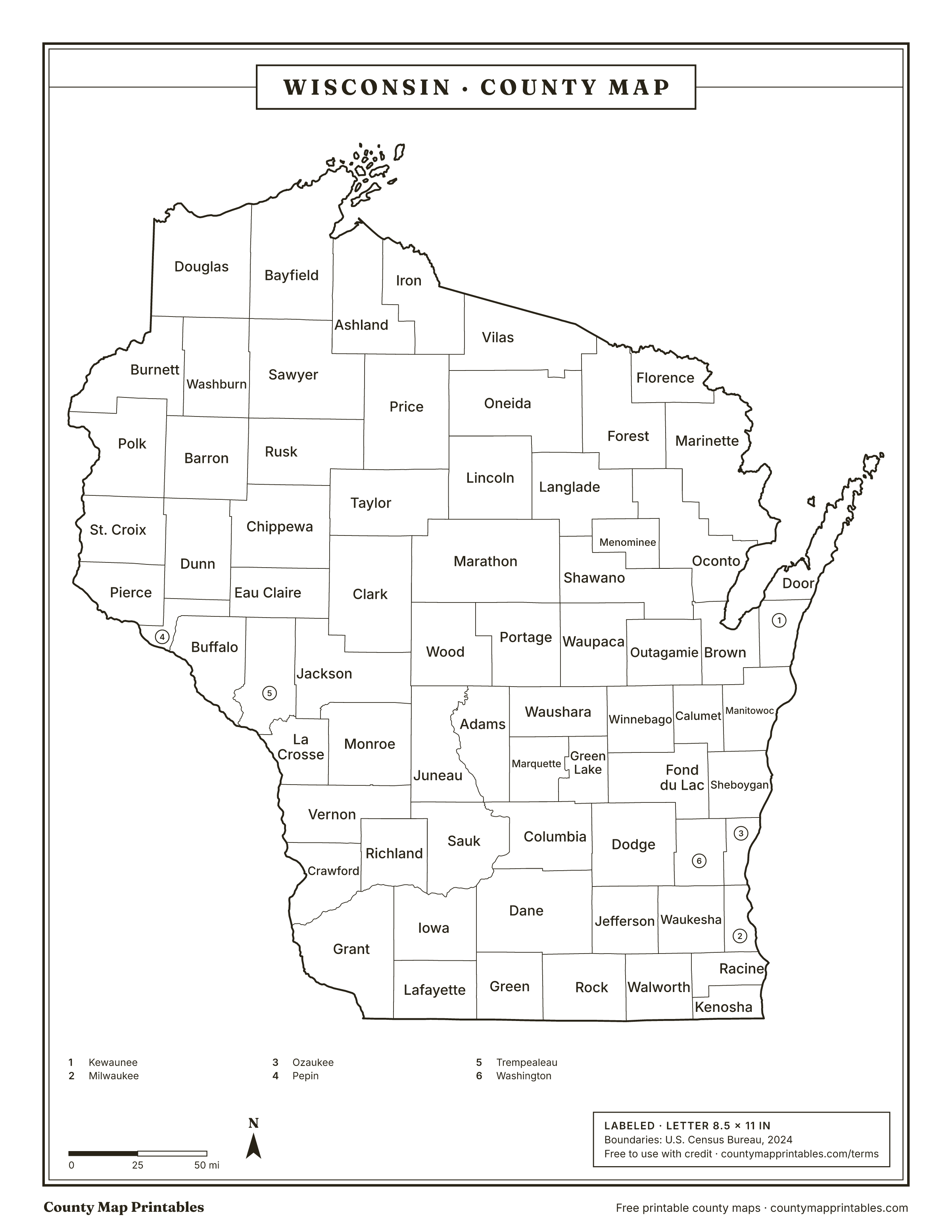
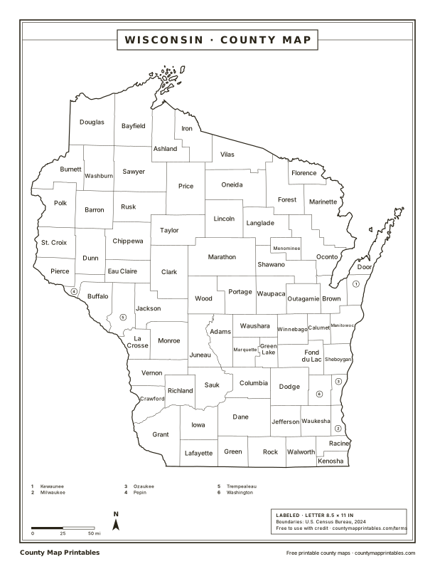
Wisconsin has 72 counties. Marathon is the largest by land area, Pepin the smallest, and Milwaukee the most populous. Print this Wisconsin (WI) county map blank or labeled, or look up any county by name below.
Map of Wisconsin counties
Free to use with credit · Licence
Wisconsin counties at a glance
Download every version
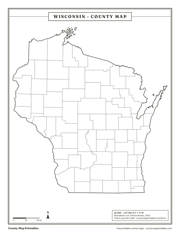 Blank
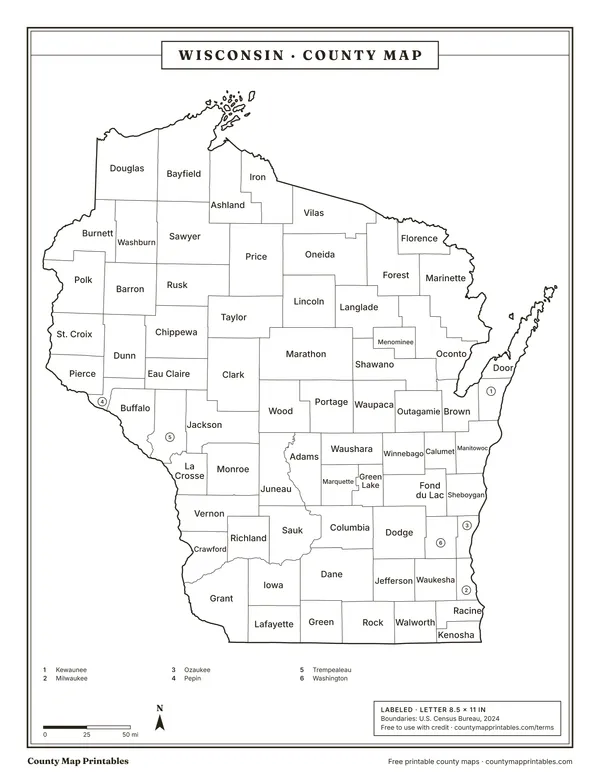 Labeled
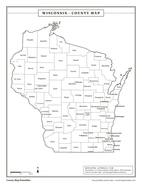 With cities
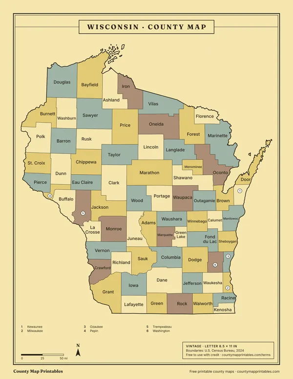 Vintage
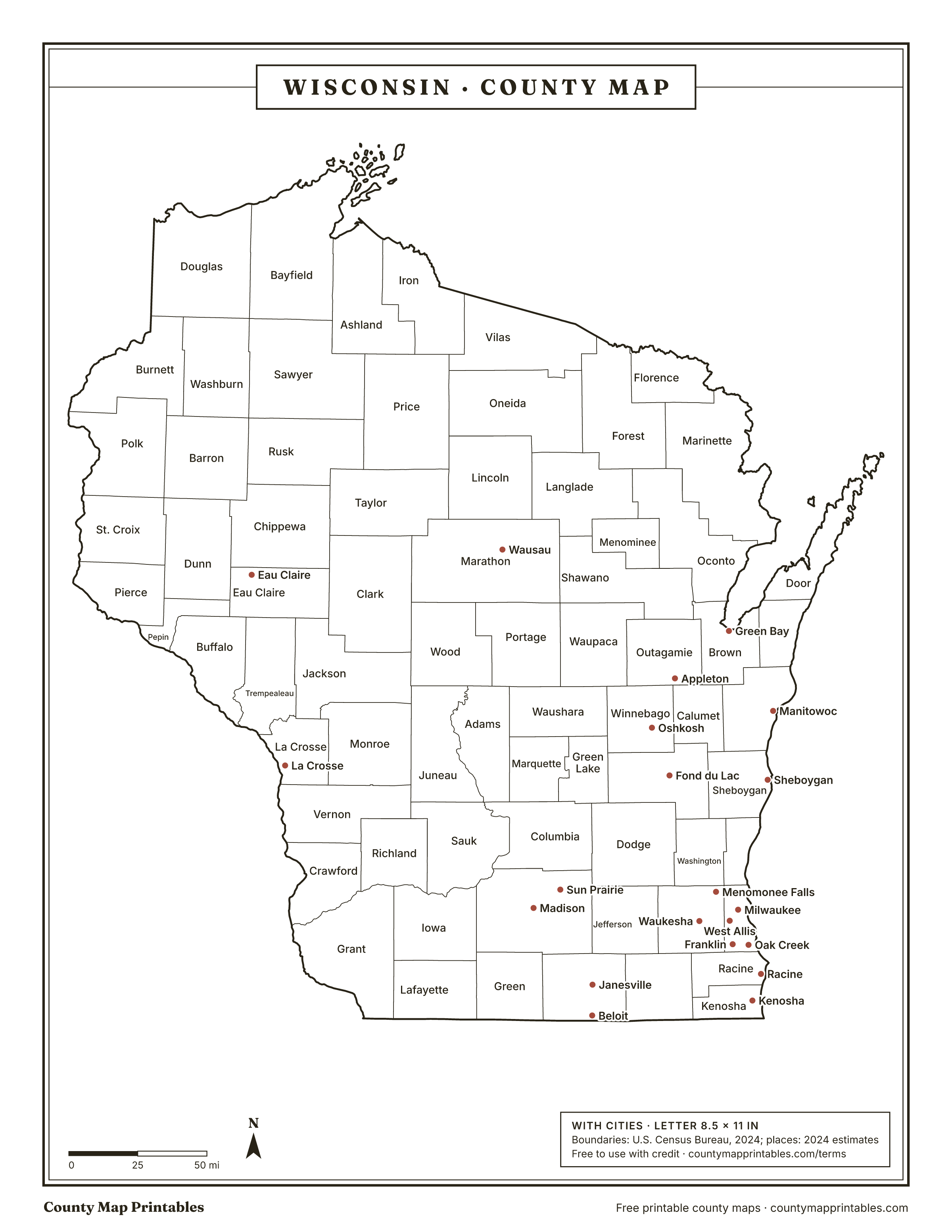
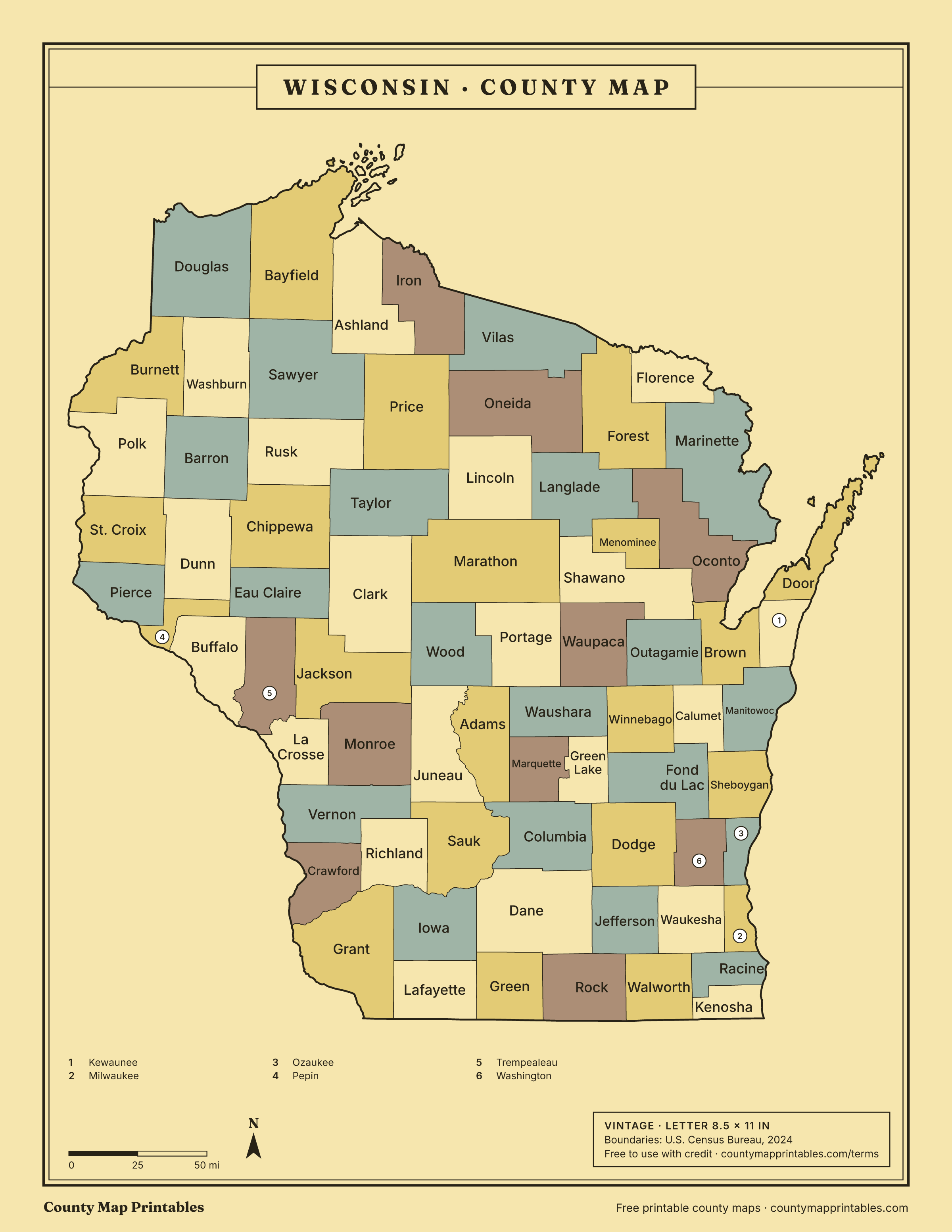
Name, FIPS, land area (sq mi, km²), population, vintage · all 72 rows
List of counties in Wisconsin
| Borders | ||||
|---|---|---|---|---|
| Milwaukee County | 55079 | 242 | 924,740 | Muskegon, MI, Ottawa, MI, Ozaukee, Racine, Washington, Waukesha |
| Dane County | 55025 | 1,197 | 588,347 | Columbia, Dodge, Green, Iowa, Jefferson, Rock, Sauk |
| Waukesha County | 55133 | 550 | 417,029 | Dodge, Jefferson, Milwaukee, Ozaukee, Racine, Walworth, Washington |
| Brown County | 55009 | 530 | 273,909 | Calumet, Door, Kewaunee, Manitowoc, Oconto, Outagamie, Shawano |
| Racine County | 55101 | 333 | 198,651 | Allegan, MI, Kenosha, Milwaukee, Ottawa, MI, Walworth, Waukesha |
| Outagamie County | 55087 | 638 | 195,390 | Brown, Calumet, Shawano, Waupaca, Winnebago |
| Winnebago County | 55139 | 435 | 173,307 | Calumet, Fond du Lac, Green Lake, Outagamie, Waupaca, Waushara |
| Kenosha County | 55059 | 272 | 168,754 | Allegan, MI, Lake, IL, McHenry, IL, Racine, Walworth |
| Rock County | 55105 | 718 | 165,461 | Boone, IL, Dane, Green, Jefferson, Walworth, Winnebago, IL |
| Marathon County | 55073 | 1,545 | 139,091 | Clark, Langlade, Lincoln, Portage, Shawano, Taylor, Waupaca, Wood |
| Washington County | 55131 | 431 | 138,727 | Dodge, Fond du Lac, Milwaukee, Ozaukee, Sheboygan, Waukesha |
| La Crosse County | 55063 | 452 | 121,060 | Houston, MN, Jackson, Monroe, Trempealeau, Vernon, Winona, MN |
| Sheboygan County | 55117 | 512 | 118,331 | Calumet, Fond du Lac, Manitowoc, Mason, MI, Oceana, MI, Ozaukee, Washington |
| Eau Claire County | 55035 | 638 | 108,830 | Buffalo, Chippewa, Clark, Dunn, Jackson, Pepin, Trempealeau |
| Walworth County | 55127 | 555 | 106,029 | Boone, IL, Jefferson, Kenosha, McHenry, IL, Racine, Rock, Waukesha |
| Fond du Lac County | 55039 | 720 | 104,269 | Calumet, Dodge, Green Lake, Sheboygan, Washington, Winnebago |
| St. Croix County | 55109 | 722 | 97,954 | Barron, Dunn, Pierce, Polk, Washington, MN |
| Ozaukee County | 55089 | 233 | 93,956 | Milwaukee, Muskegon, MI, Oceana, MI, Sheboygan, Washington, Waukesha |
| Dodge County | 55027 | 876 | 88,635 | Columbia, Dane, Fond du Lac, Green Lake, Jefferson, Washington, Waukesha |
| Jefferson County | 55055 | 557 | 86,245 | Dane, Dodge, Rock, Walworth, Waukesha |
| Manitowoc County | 55071 | 589 | 81,513 | Brown, Calumet, Kewaunee, Manistee, MI, Mason, MI, Sheboygan |
| Wood County | 55141 | 793 | 73,943 | Adams, Clark, Jackson, Juneau, Marathon, Portage |
| Portage County | 55097 | 801 | 72,040 | Adams, Marathon, Shawano, Waupaca, Waushara, Wood |
| Chippewa County | 55017 | 1,008 | 67,323 | Barron, Clark, Dunn, Eau Claire, Rusk, Taylor |
| Sauk County | 55111 | 832 | 66,486 | Adams, Columbia, Dane, Iowa, Juneau, Richland, Vernon |
| Columbia County | 55021 | 766 | 58,113 | Adams, Dane, Dodge, Green Lake, Juneau, Marquette, Sauk |
| Calumet County | 55015 | 318 | 53,602 | Brown, Fond du Lac, Manitowoc, Outagamie, Sheboygan, Winnebago |
| Grant County | 55043 | 1,148 | 52,330 | Clayton, IA, Crawford, Dubuque, IA, Iowa, Jo Daviess, IL, Lafayette, Richland |
| Waupaca County | 55135 | 748 | 51,171 | Marathon, Outagamie, Portage, Shawano, Waushara, Winnebago |
| Barron County | 55005 | 863 | 46,810 | Burnett, Chippewa, Dunn, Polk, Rusk, Sawyer, St. Croix, Washburn |
| Monroe County | 55081 | 901 | 46,370 | Jackson, Juneau, La Crosse, Vernon |
| Dunn County | 55033 | 850 | 46,135 | Barron, Chippewa, Eau Claire, Pepin, Pierce, Polk, St. Croix |
| Polk County | 55095 | 914 | 45,831 | Barron, Burnett, Chisago, MN, Dunn, St. Croix, Washington, MN |
| Douglas County | 55031 | 1,304 | 44,276 | Bayfield, Burnett, Carlton, MN, Lake, MN, Pine, MN, Sawyer, St. Louis, MN, Washburn |
| Pierce County | 55093 | 574 | 43,380 | Dakota, MN, Dunn, Goodhue, MN, Pepin, St. Croix, Washington, MN |
| Marinette County | 55075 | 1,400 | 42,343 | Dickinson, MI, Door, Florence, Forest, Menominee, MI, Oconto |
| Shawano County | 55115 | 893 | 41,299 | Brown, Langlade, Marathon, Menominee, Oconto, Outagamie, Portage, Waupaca |
| Oconto County | 55083 | 998 | 40,037 | Brown, Door, Forest, Langlade, Marinette, Menominee, Shawano |
| Oneida County | 55085 | 1,114 | 38,175 | Forest, Langlade, Lincoln, Price, Vilas |
| Green County | 55045 | 584 | 37,183 | Dane, Iowa, Lafayette, Rock, Stephenson, IL, Winnebago, IL |
| Clark County | 55019 | 1,210 | 34,801 | Chippewa, Eau Claire, Jackson, Marathon, Taylor, Wood |
| Vernon County | 55123 | 792 | 31,351 | Allamakee, IA, Crawford, Houston, MN, Juneau, La Crosse, Monroe, Richland, Sauk |
| Trempealeau County | 55121 | 733 | 30,801 | Buffalo, Eau Claire, Jackson, La Crosse, Winona, MN |
| Door County | 55029 | 482 | 30,512 | Benzie, MI, Brown, Delta, MI, Kewaunee, Leelanau, MI, Marinette, Menominee, MI, Oconto |
| Lincoln County | 55069 | 879 | 28,461 | Langlade, Marathon, Oneida, Price, Taylor |
| Juneau County | 55057 | 767 | 26,590 | Adams, Columbia, Jackson, Monroe, Sauk, Vernon, Wood |
| Waushara County | 55137 | 626 | 25,079 | Adams, Green Lake, Marquette, Portage, Waupaca, Winnebago |
| Iowa County | 55049 | 763 | 23,963 | Dane, Grant, Green, Lafayette, Richland, Sauk |
| Vilas County | 55125 | 858 | 23,948 | Forest, Gogebic, MI, Iron, MI, Iron, Oneida, Price |
| Adams County | 55001 | 646 | 21,352 | Columbia, Juneau, Marquette, Portage, Sauk, Waushara, Wood |
| Jackson County | 55053 | 988 | 21,027 | Clark, Eau Claire, Juneau, La Crosse, Monroe, Trempealeau, Wood |
| Kewaunee County | 55061 | 343 | 20,751 | Benzie, MI, Brown, Door, Manistee, MI, Manitowoc |
| Taylor County | 55119 | 975 | 20,167 | Chippewa, Clark, Lincoln, Marathon, Price, Rusk |
| Langlade County | 55067 | 871 | 19,535 | Forest, Lincoln, Marathon, Menominee, Oconto, Oneida, Shawano |
| Green Lake County | 55047 | 350 | 19,370 | Columbia, Dodge, Fond du Lac, Marquette, Waushara, Winnebago |
| Sawyer County | 55113 | 1,258 | 18,835 | Ashland, Barron, Bayfield, Douglas, Price, Rusk, Washburn |
| Lafayette County | 55065 | 634 | 17,306 | Grant, Green, Iowa, Jo Daviess, IL, Stephenson, IL |
| Burnett County | 55013 | 822 | 17,187 | Barron, Chisago, MN, Douglas, Pine, MN, Polk, Washburn |
| Richland County | 55103 | 586 | 17,123 | Crawford, Grant, Iowa, Sauk, Vernon |
| Washburn County | 55129 | 797 | 16,982 | Barron, Bayfield, Burnett, Douglas, Rusk, Sawyer |
| Bayfield County | 55007 | 1,478 | 16,838 | Ashland, Douglas, Lake, MN, Sawyer, Washburn |
| Ashland County | 55003 | 1,045 | 16,196 | Bayfield, Cook, MN, Gogebic, MI, Iron, Lake, MN, Ontonagon, MI, Price, Sawyer |
| Crawford County | 55023 | 571 | 16,008 | Allamakee, IA, Clayton, IA, Grant, Richland, Vernon |
| Marquette County | 55077 | 456 | 15,743 | Adams, Columbia, Green Lake, Waushara |
| Rusk County | 55107 | 914 | 14,168 | Barron, Chippewa, Price, Sawyer, Taylor, Washburn |
| Price County | 55099 | 1,254 | 14,087 | Ashland, Iron, Lincoln, Oneida, Rusk, Sawyer, Taylor, Vilas |
| Buffalo County | 55011 | 676 | 13,464 | Eau Claire, Pepin, Trempealeau, Wabasha, MN, Winona, MN |
| Forest County | 55041 | 1,014 | 9,506 | Florence, Iron, MI, Langlade, Marinette, Oconto, Oneida, Vilas |
| Pepin County | 55091 | 232 | 7,555 | Buffalo, Dunn, Eau Claire, Goodhue, MN, Pierce, Wabasha, MN |
| Iron County | 55051 | 758 | 6,235 | Ashland, Gogebic, MI, Price, Vilas |
| Florence County | 55037 | 488 | 4,673 | Dickinson, MI, Forest, Iron, MI, Marinette |
| Menominee County | 55078 | 358 | 4,286 | Langlade, Oconto, Shawano |
Hover a row to find the county on the map. Areas: Census Gazetteer 2024. Population: Census Bureau estimates for July 1, 2024.
How many counties are in Wisconsin?
Wisconsin has 72 counties.
About Wisconsin's counties
- 9 of Wisconsin's counties have more water area than land area, because their boundaries run out into the Great Lakes.
- The most populous is Milwaukee County, with about 924,740 people; the least populous is Menominee County, with 4,286.
Sources: U.S. Census Bureau. Last checked 2026-11-18.
Neighbouring states
- Iowa99 counties
- Illinois102 counties
- Michigan83 counties
- Minnesota87 counties
Questions
What is the largest county in Wisconsin?
Marathon County, with 1,545 square miles of land.
What is the smallest county in Wisconsin?
Pepin County, with 232 square miles of land.
Which county in Wisconsin has the most people?
Milwaukee County, with an estimated 924,740 people (2024).
Which county is Milwaukee in?
Milwaukee, the largest city in Wisconsin, is in Milwaukee County. Large cities can spill into neighbouring counties; Milwaukee County holds the city's Census internal point.
Can I use these maps in class or at work?
Yes. Print, copy and use them in lessons, reports and slides, with the credit “Map: countymapprintables.com”. Keeping the footer on the file counts as the credit.
Boundaries: U.S. Census Bureau cartographic boundary files, 2024 (1:500,000). County facts: Census Gazetteer and county population estimates. How these maps are made.