- Home
- County maps
- California
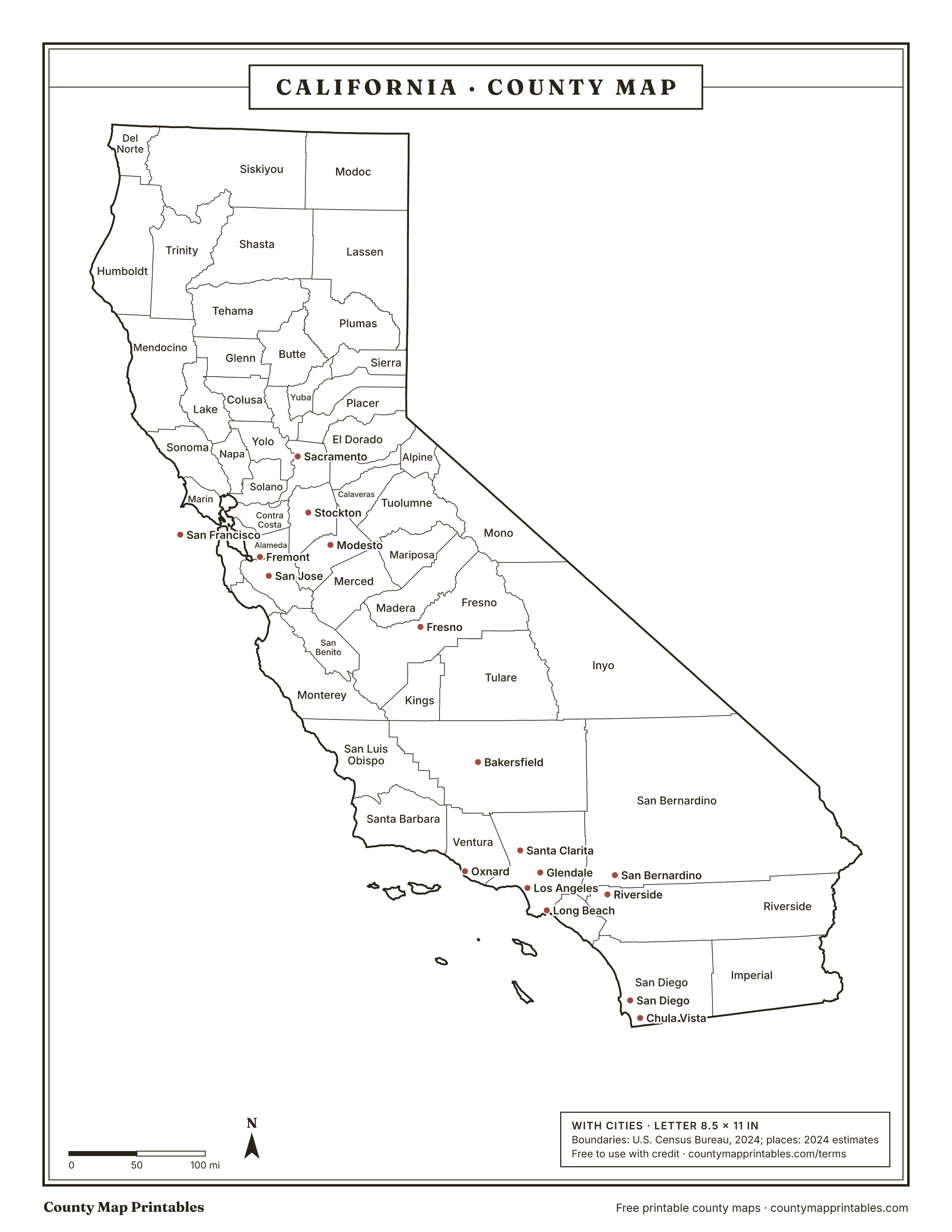
California County Map
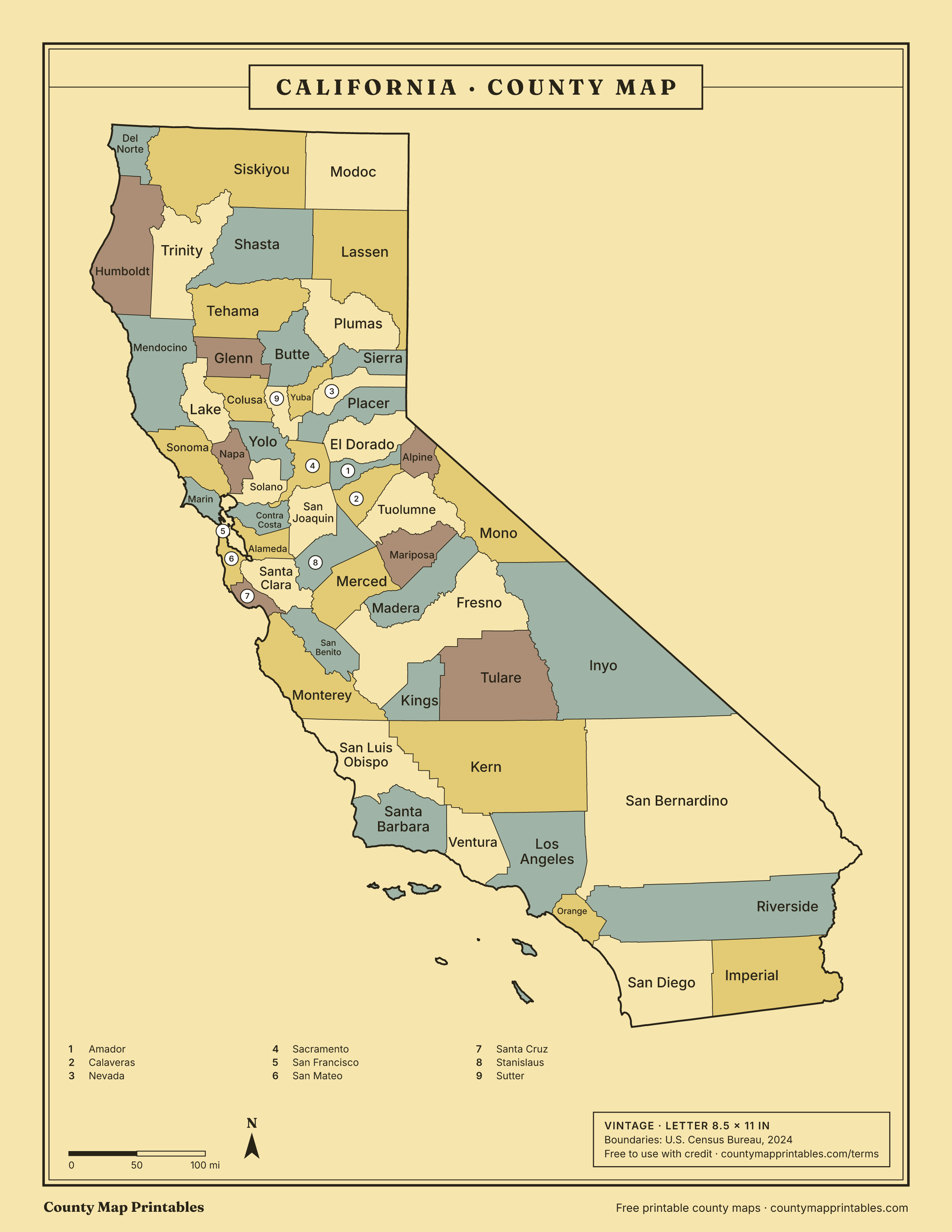
California has 58 counties. San Bernardino is the largest by land area, San Francisco the smallest, and Los Angeles the most populous. Print this California (CA) county map blank or labeled, or look up any county by name below.
Map of California counties
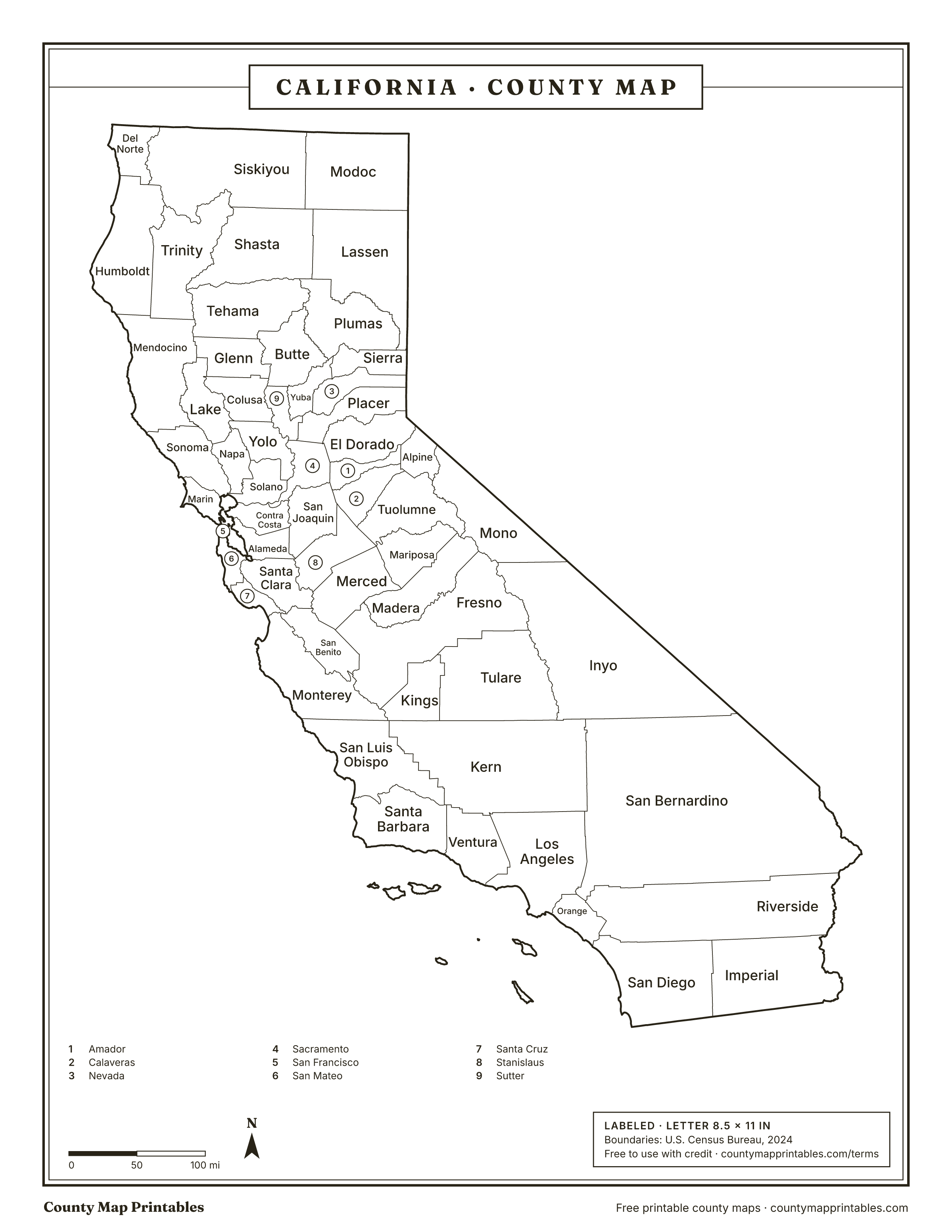
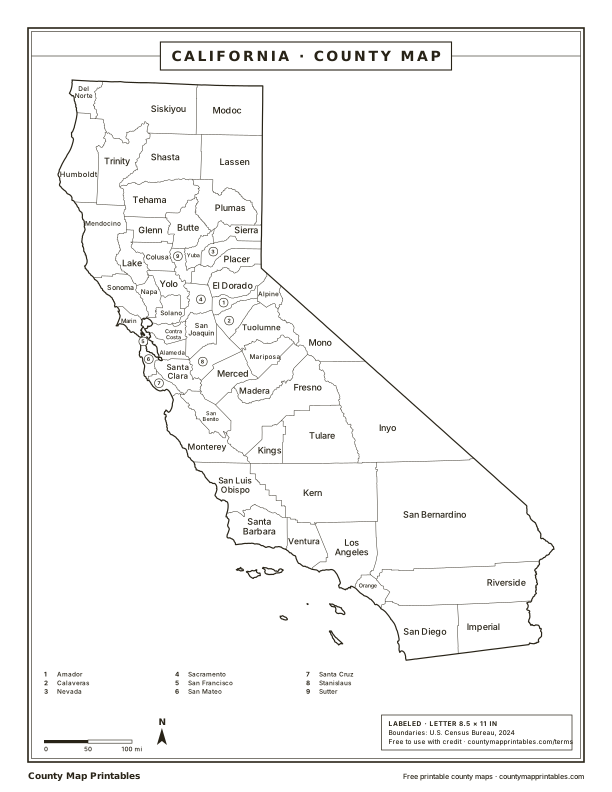
Free to use with credit · Licence
California counties at a glance
- counties
- 58
- Largest by area
- San Bernardino20,068 sq mi
- Smallest by area
- San Francisco46.7 sq mi
- Most populous
- Los Angeles9,757,179
- Least populous
- Alpine1,099
- Total land area
- 155,860sq mi
Download every version
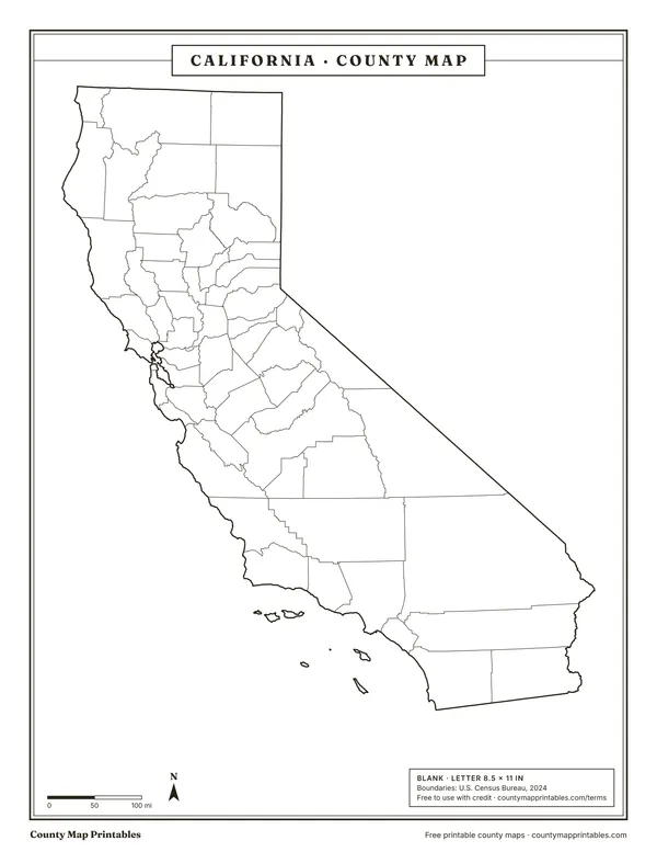 BlankTabloid 11×17 PDF
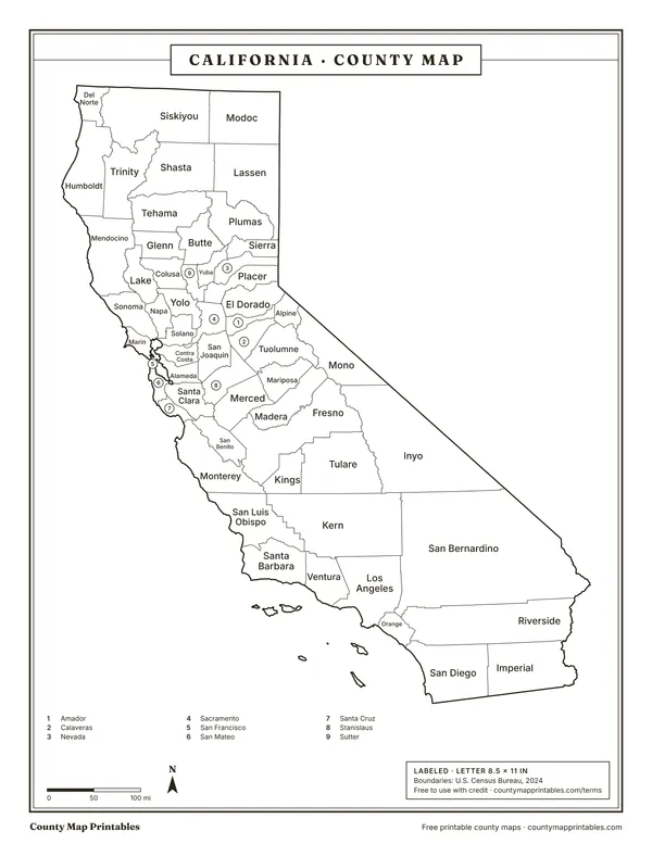 LabeledTabloid 11×17 PDF
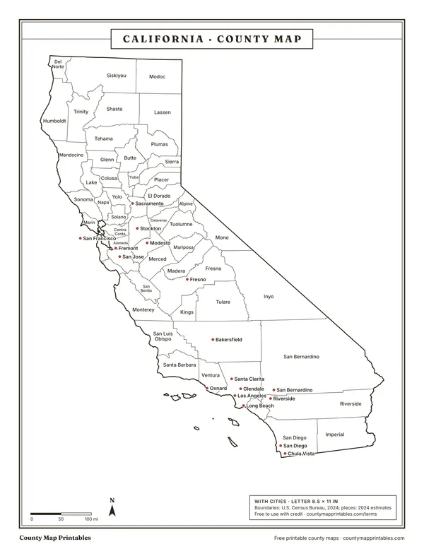 With citiesTabloid 11×17 PDF
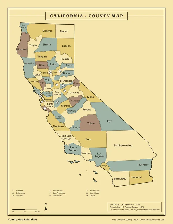 VintageTabloid 11×17 PDF
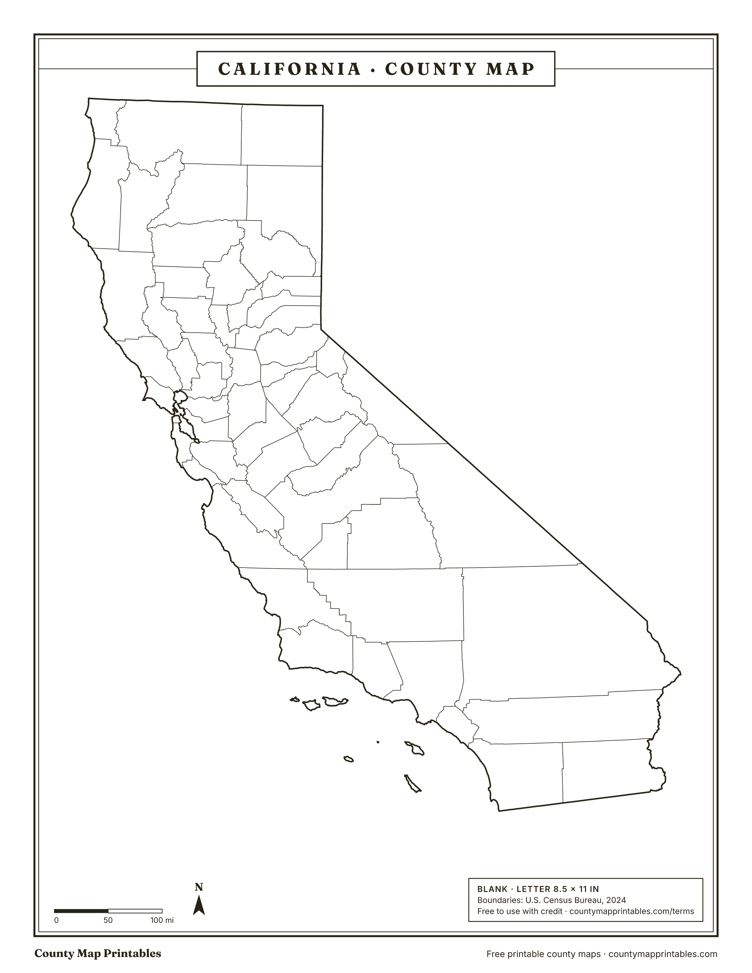
Name, FIPS, land area (sq mi, km²), population, vintage · all 58 rows
List of counties in California
| Borders | ||||
|---|---|---|---|---|
| Los Angeles County | 06037 | 4,060 | 9,757,179 | Kern, Orange, San Bernardino, Ventura |
| San Diego County | 06073 | 4,211 | 3,298,799 | Imperial, Orange, Riverside |
| Orange County | 06059 | 793 | 3,170,435 | Los Angeles, Riverside, San Bernardino, San Diego |
| Riverside County | 06065 | 7,209 | 2,529,933 | Imperial, La Paz, AZ, Orange, San Bernardino, San Diego |
| San Bernardino County | 06071 | 20,068 | 2,214,281 | Clark, NV, Inyo, Kern, La Paz, AZ, Los Angeles, Mohave, AZ, Orange, Riverside |
| Santa Clara County | 06085 | 1,291 | 1,926,325 | Alameda, Merced, San Benito, San Mateo, Santa Cruz, Stanislaus |
| Alameda County | 06001 | 738 | 1,649,060 | Contra Costa, San Francisco, San Joaquin, San Mateo, Santa Clara, Stanislaus |
| Sacramento County | 06067 | 965 | 1,611,231 | Amador, Contra Costa, El Dorado, Placer, San Joaquin, Solano, Sutter, Yolo |
| Contra Costa County | 06013 | 717 | 1,172,607 | Alameda, Marin, Sacramento, San Francisco, San Joaquin, Solano, Sonoma |
| Fresno County | 06019 | 5,959 | 1,024,125 | Inyo, Kings, Madera, Merced, Mono, Monterey, San Benito, Tulare |
| Kern County | 06029 | 8,135 | 922,529 | Inyo, Kings, Los Angeles, San Bernardino, San Luis Obispo, Santa Barbara, Tulare, Ventura |
| Ventura County | 06111 | 1,841 | 835,427 | Kern, Los Angeles, Santa Barbara |
| San Francisco County | 06075 | 46.7 | 827,526 | Alameda, Contra Costa, Marin, San Mateo |
| San Joaquin County | 06077 | 1,392 | 816,108 | Alameda, Amador, Calaveras, Contra Costa, Sacramento, Stanislaus |
| San Mateo County | 06081 | 449 | 742,893 | Alameda, San Francisco, Santa Clara, Santa Cruz |
| Stanislaus County | 06099 | 1,496 | 556,972 | Alameda, Calaveras, Mariposa, Merced, San Joaquin, Santa Clara, Tuolumne |
| Sonoma County | 06097 | 1,575 | 485,375 | Contra Costa, Lake, Marin, Mendocino, Napa, Solano |
| Tulare County | 06107 | 4,824 | 483,546 | Fresno, Inyo, Kern, Kings |
| Solano County | 06095 | 822 | 455,101 | Contra Costa, Marin, Napa, Sacramento, Sonoma, Yolo |
| Santa Barbara County | 06083 | 2,734 | 444,500 | Kern, San Luis Obispo, Ventura |
| Monterey County | 06053 | 3,282 | 436,251 | Fresno, Kings, San Benito, San Luis Obispo, Santa Cruz |
| Placer County | 06061 | 1,407 | 433,822 | Carson City, NV, Douglas, NV, El Dorado, Nevada, Sacramento, Sutter, Washoe, NV, Yuba |
| Merced County | 06047 | 1,938 | 296,774 | Fresno, Madera, Mariposa, San Benito, Santa Clara, Stanislaus |
| San Luis Obispo County | 06079 | 3,301 | 281,843 | Kern, Kings, Monterey, Santa Barbara |
| Santa Cruz County | 06087 | 445 | 262,406 | Monterey, San Benito, San Mateo, Santa Clara |
| Marin County | 06041 | 520 | 256,400 | Contra Costa, San Francisco, Solano, Sonoma |
| Yolo County | 06113 | 1,013 | 225,251 | Colusa, Lake, Napa, Sacramento, Solano, Sutter |
| Butte County | 06007 | 1,637 | 208,334 | Colusa, Glenn, Plumas, Sutter, Tehama, Yuba |
| El Dorado County | 06017 | 1,708 | 192,823 | Alpine, Amador, Douglas, NV, Placer, Sacramento |
| Imperial County | 06025 | 4,176 | 181,724 | La Paz, AZ, Riverside, San Diego, Yuma, AZ |
| Shasta County | 06089 | 3,776 | 181,121 | Lassen, Modoc, Plumas, Siskiyou, Tehama, Trinity |
| Madera County | 06039 | 2,137 | 165,432 | Fresno, Mariposa, Merced, Mono, Tuolumne |
| Kings County | 06031 | 1,391 | 154,913 | Fresno, Kern, Monterey, San Luis Obispo, Tulare |
| Napa County | 06055 | 752 | 132,727 | Lake, Solano, Sonoma, Yolo |
| Humboldt County | 06023 | 3,568 | 132,380 | Del Norte, Mendocino, Siskiyou, Trinity |
| Nevada County | 06057 | 958 | 102,195 | Placer, Sierra, Washoe, NV, Yuba |
| Sutter County | 06101 | 603 | 98,545 | Butte, Colusa, Placer, Sacramento, Yolo, Yuba |
| Mendocino County | 06045 | 3,507 | 89,175 | Glenn, Humboldt, Lake, Sonoma, Tehama, Trinity |
| Yuba County | 06115 | 632 | 87,469 | Butte, Nevada, Placer, Plumas, Sierra, Sutter |
| San Benito County | 06069 | 1,389 | 69,159 | Fresno, Merced, Monterey, Santa Clara, Santa Cruz |
| Lake County | 06033 | 1,255 | 67,764 | Colusa, Glenn, Mendocino, Napa, Sonoma, Yolo |
| Tehama County | 06103 | 2,949 | 64,451 | Butte, Glenn, Mendocino, Plumas, Shasta, Trinity |
| Tuolumne County | 06109 | 2,221 | 53,893 | Alpine, Calaveras, Madera, Mariposa, Mono, Stanislaus |
| Calaveras County | 06009 | 1,020 | 46,505 | Alpine, Amador, San Joaquin, Stanislaus, Tuolumne |
| Siskiyou County | 06093 | 6,279 | 42,498 | Del Norte, Humboldt, Jackson, OR, Josephine, OR, Klamath, OR, Modoc, Shasta, Trinity |
| Amador County | 06005 | 595 | 42,026 | Alpine, Calaveras, El Dorado, Sacramento, San Joaquin |
| Lassen County | 06035 | 4,541 | 28,340 | Modoc, Plumas, Shasta, Sierra, Washoe, NV |
| Glenn County | 06021 | 1,314 | 28,304 | Butte, Colusa, Lake, Mendocino, Tehama |
| Del Norte County | 06015 | 1,006 | 27,009 | Curry, OR, Humboldt, Josephine, OR, Siskiyou |
| Colusa County | 06011 | 1,151 | 22,074 | Butte, Glenn, Lake, Sutter, Yolo |
| Plumas County | 06063 | 2,553 | 18,834 | Butte, Lassen, Shasta, Sierra, Tehama, Yuba |
| Inyo County | 06027 | 10,197 | 18,485 | Clark, NV, Esmeralda, NV, Fresno, Kern, Mono, Nye, NV, San Bernardino, Tulare |
| Mariposa County | 06043 | 1,449 | 17,048 | Madera, Merced, Stanislaus, Tuolumne |
| Trinity County | 06105 | 3,179 | 15,642 | Humboldt, Mendocino, Shasta, Siskiyou, Tehama |
| Mono County | 06051 | 3,049 | 12,991 | Alpine, Douglas, NV, Esmeralda, NV, Fresno, Inyo, Lyon, NV, Madera, Mineral, NV, Tuolumne |
| Modoc County | 06049 | 3,948 | 8,491 | Klamath, OR, Lake, OR, Lassen, Shasta, Siskiyou, Washoe, NV |
| Sierra County | 06091 | 953 | 3,113 | Lassen, Nevada, Plumas, Washoe, NV, Yuba |
| Alpine County | 06003 | 738 | 1,099 | Amador, Calaveras, Douglas, NV, El Dorado, Mono, Tuolumne |
Hover a row to find the county on the map. Areas: Census Gazetteer 2024. Population: Census Bureau estimates for July 1, 2024.
How many counties are in California?
California has 58 counties.
About California's counties
- San Bernardino County is the largest county by land area in the contiguous United States (20,068 square miles).
- San Francisco County is the most densely populated county outside New York City, at about 17,720 people per square mile.
- San Francisco is a consolidated city and county: one government for both.
- The most populous is Los Angeles County, with about 9,757,179 people; the least populous is Alpine County, with 1,099.
Sources: U.S. Census Bureau. Last checked 2026-11-18.
Neighbouring states
- Arizona15 counties
- Nevada17 counties
- Oregon36 counties
Questions
What is the largest county in California?
San Bernardino County, with 20,068 square miles of land.
What is the smallest county in California?
San Francisco County, with 46.7 square miles of land.
Which county in California has the most people?
Los Angeles County, with an estimated 9,757,179 people (2024).
Which county is Los Angeles in?
Los Angeles, the largest city in California, is in Los Angeles County. Large cities can spill into neighbouring counties; Los Angeles County holds the city's Census internal point.
Can I use these maps in class or at work?
Yes. Print, copy and use them in lessons, reports and slides, with the credit “Map: countymapprintables.com”. Keeping the footer on the file counts as the credit.
Boundaries: U.S. Census Bureau cartographic boundary files, 2024 (1:500,000). County facts: Census Gazetteer and county population estimates. How these maps are made.