- Home
- County maps
- Florida
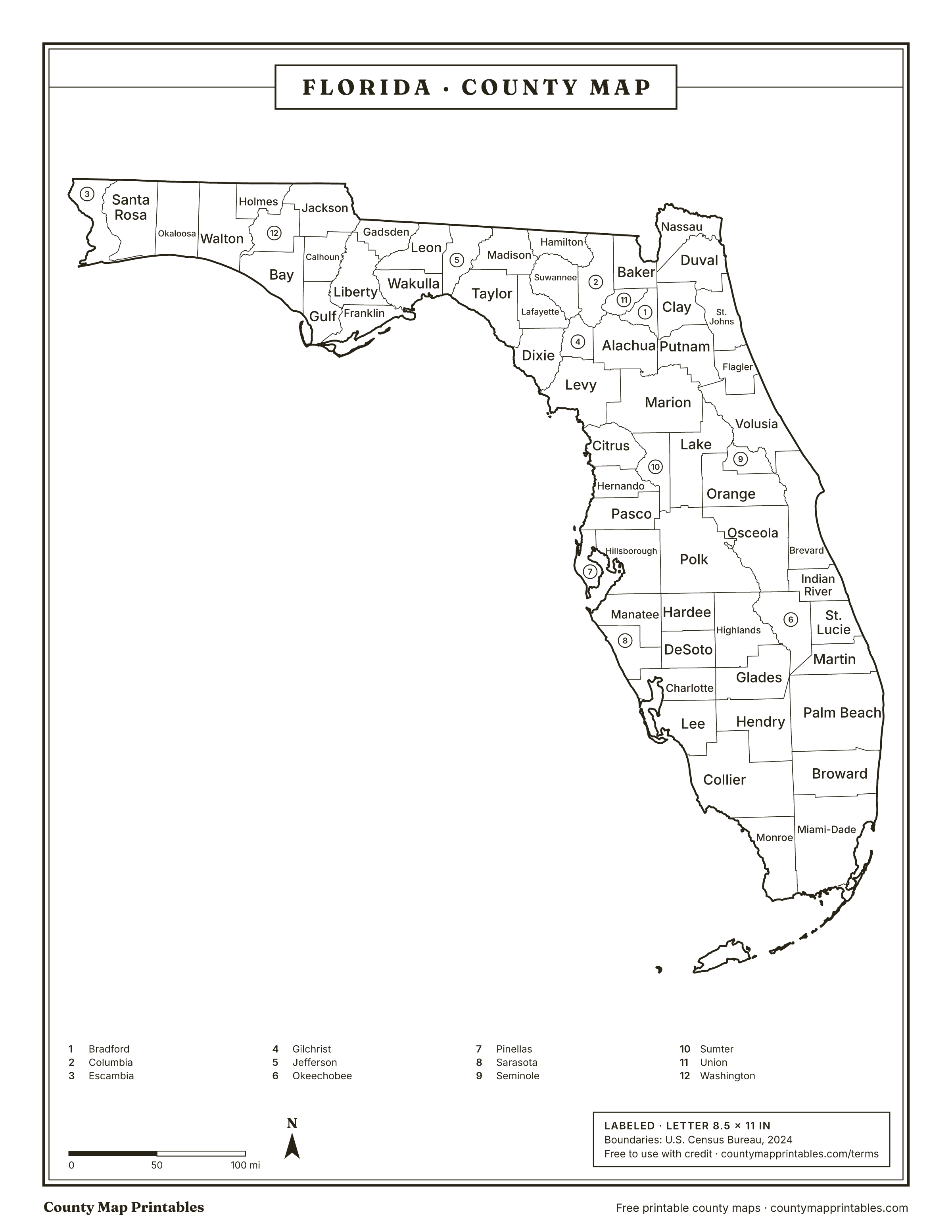
Florida County Map
Florida has 67 counties. Collier is the largest by land area, Union the smallest, and Miami-Dade the most populous. Print this Florida (FL) county map blank or labeled, or look up any county by name below.
Map of Florida counties
Free to use with credit · Licence
Florida counties at a glance
- counties
- 67
- Largest by area
- Collier1,997 sq mi
- Smallest by area
- Union244 sq mi
- Most populous
- Miami-Dade2,838,461
- Least populous
- Liberty7,955
- Total land area
- 53,655sq mi
Download every version
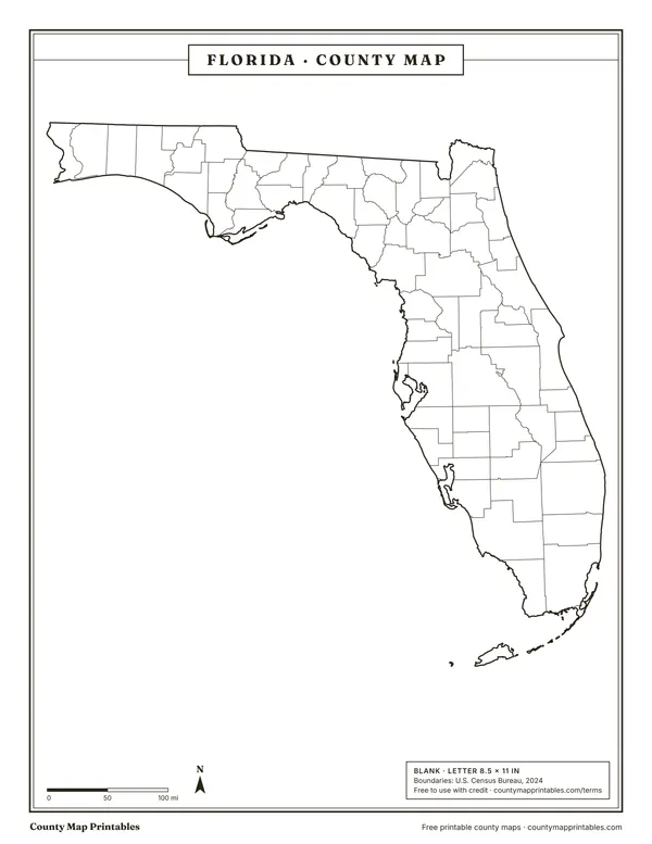 BlankTabloid 11×17 PDF
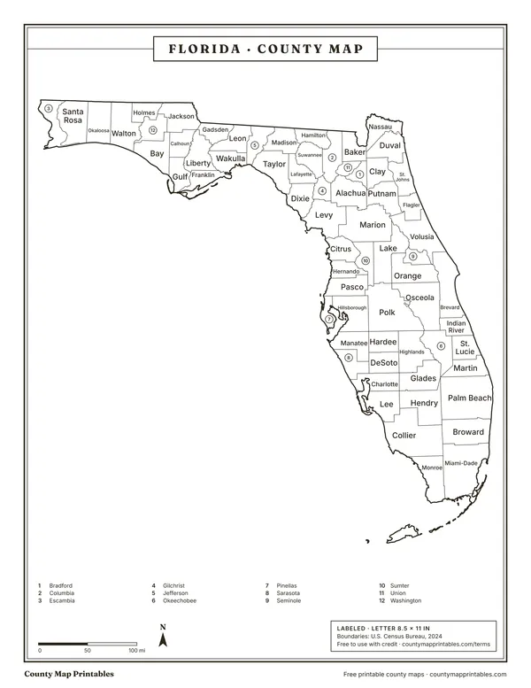 LabeledTabloid 11×17 PDF
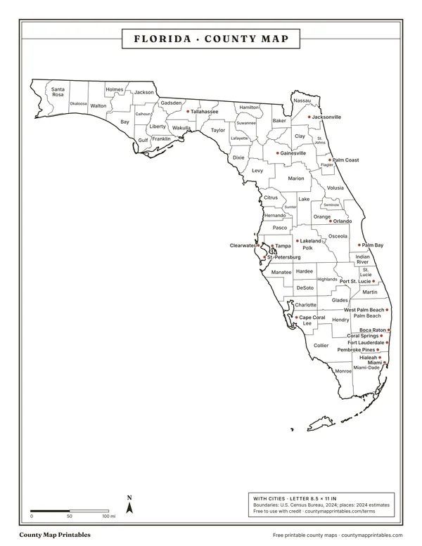 With citiesTabloid 11×17 PDF
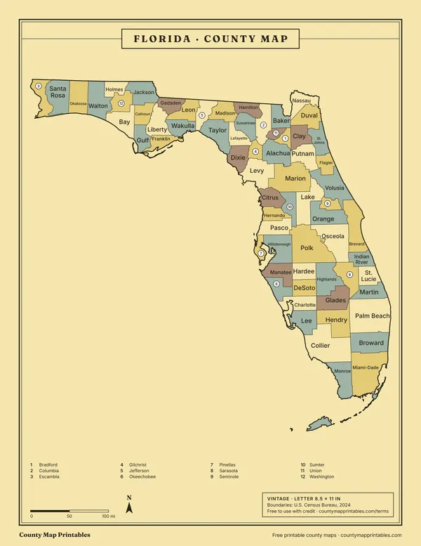 VintageTabloid 11×17 PDF
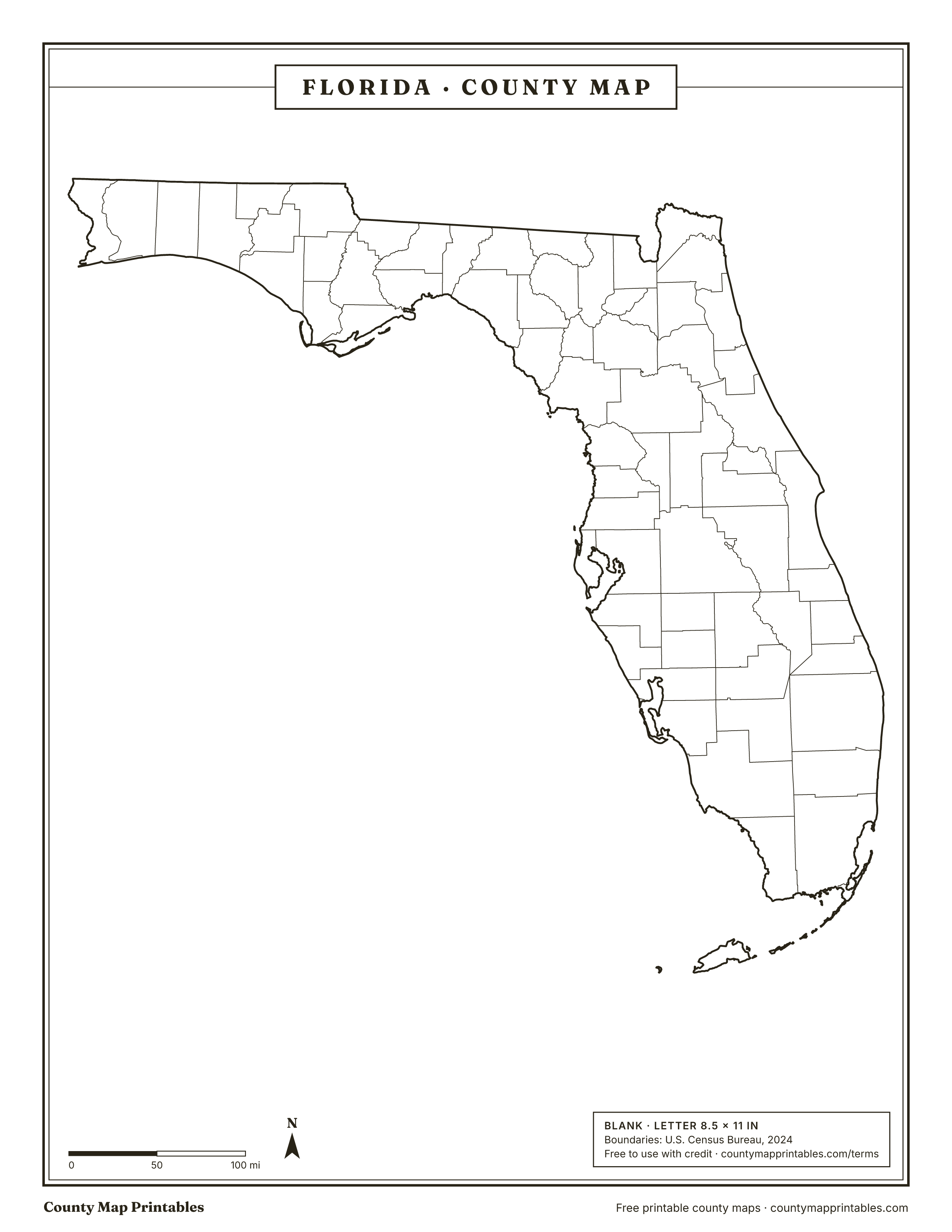
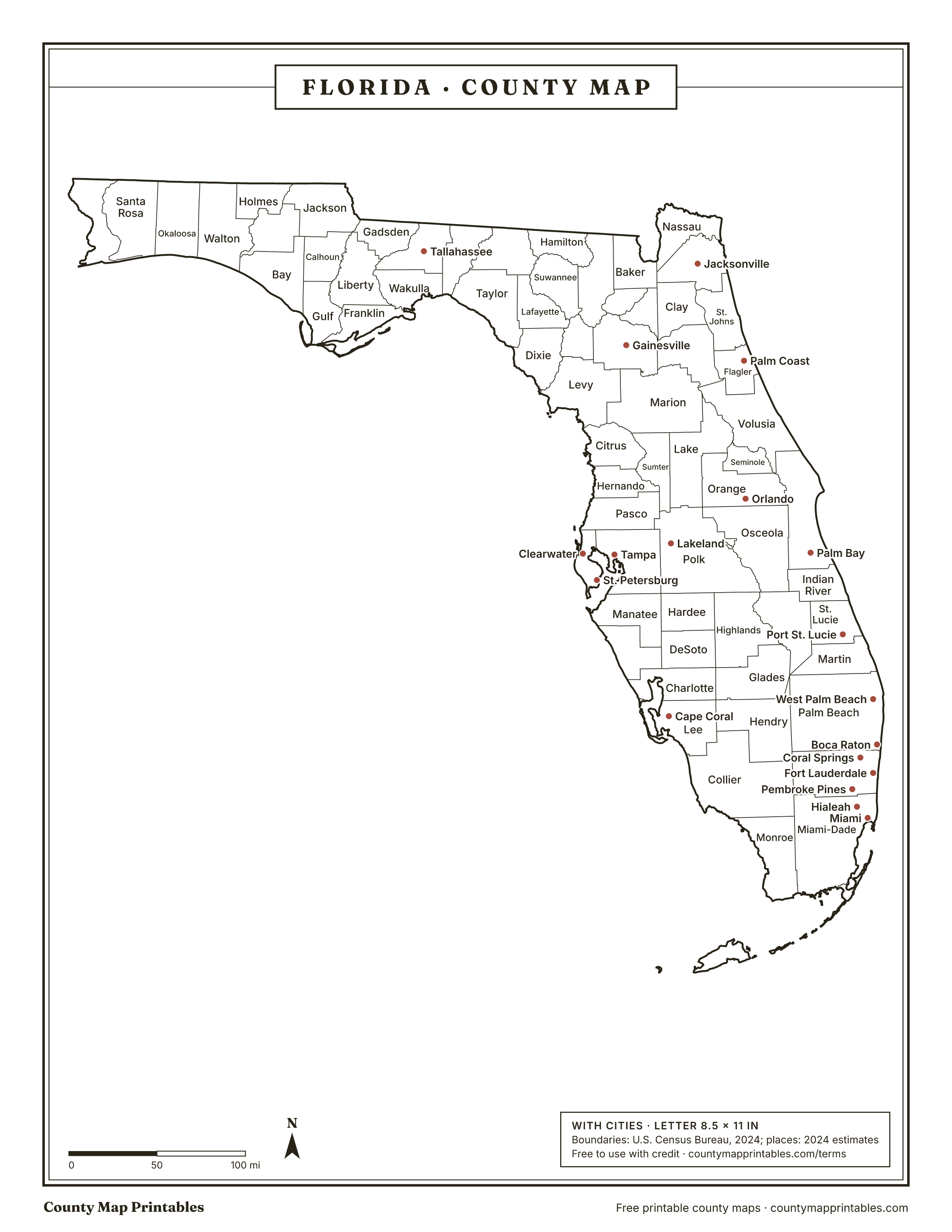
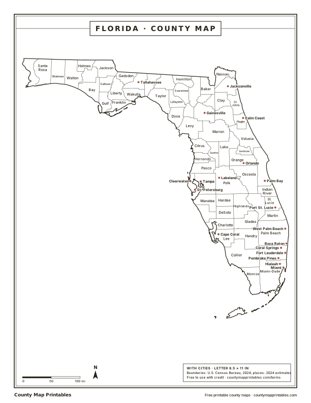
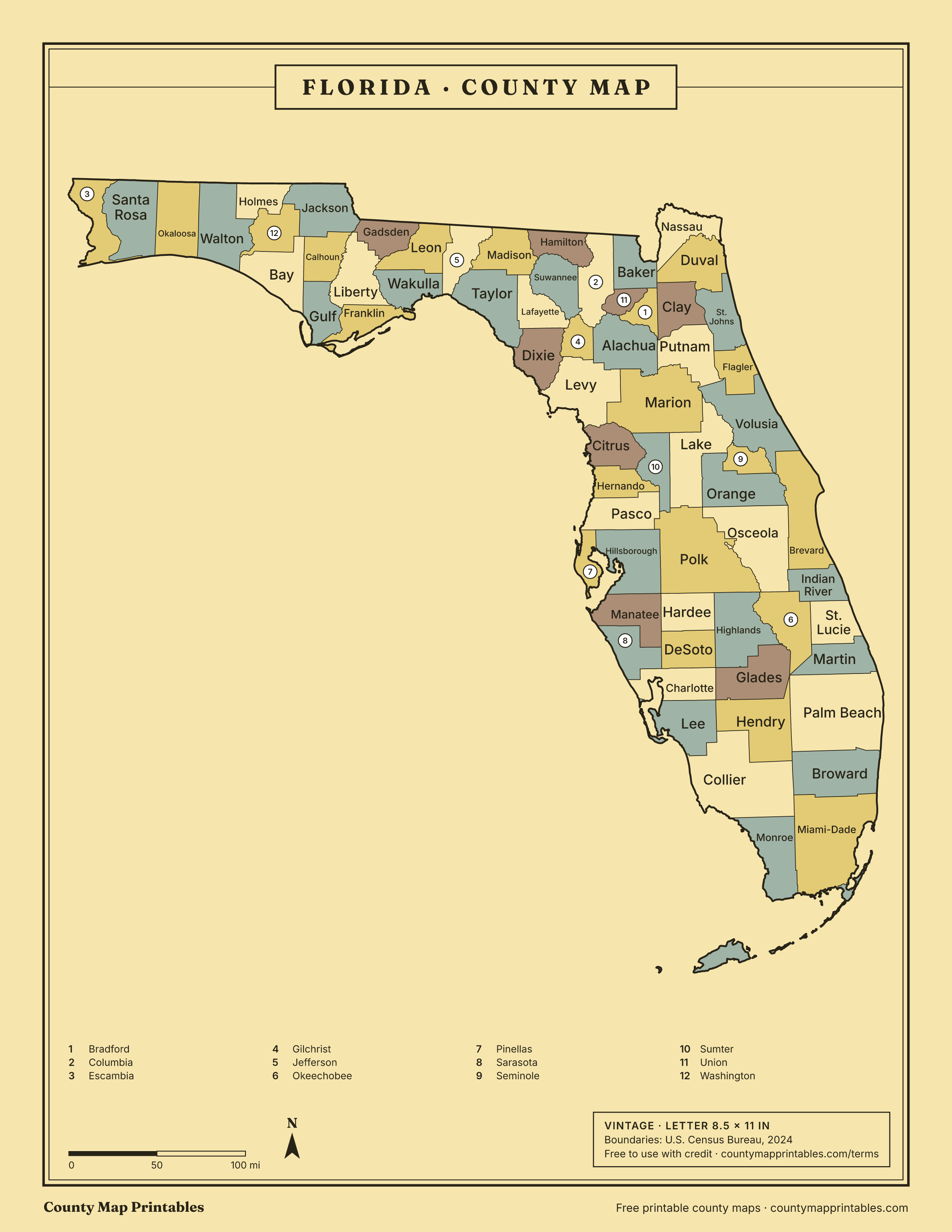
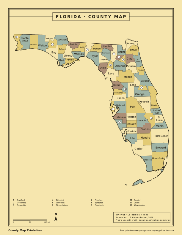
Name, FIPS, land area (sq mi, km²), population, vintage · all 67 rows
List of counties in Florida
| Borders | ||||
|---|---|---|---|---|
| Miami-Dade County | 12086 | 1,900 | 2,838,461 | Broward, Collier, Monroe |
| Broward County | 12011 | 1,203 | 2,037,472 | Collier, Hendry, Miami-Dade, Palm Beach |
| Palm Beach County | 12099 | 1,964 | 1,582,055 | Broward, Glades, Hendry, Martin, Okeechobee |
| Hillsborough County | 12057 | 1,023 | 1,581,426 | Hardee, Manatee, Pasco, Pinellas, Polk |
| Orange County | 12095 | 903 | 1,533,646 | Brevard, Lake, Osceola, Polk, Seminole, Volusia |
| Duval County | 12031 | 763 | 1,055,159 | Baker, Clay, Nassau, St. Johns |
| Pinellas County | 12103 | 274 | 965,870 | Hillsborough, Pasco |
| Lee County | 12071 | 781 | 860,959 | Charlotte, Collier, Glades, Hendry |
| Polk County | 12105 | 1,798 | 852,878 | Hardee, Highlands, Hillsborough, Lake, Manatee, Okeechobee, Orange, Osceola, Pasco, Sumter |
| Pasco County | 12101 | 747 | 659,114 | Hernando, Hillsborough, Pinellas, Polk, Sumter |
| Brevard County | 12009 | 1,015 | 658,447 | Indian River, Orange, Osceola, Seminole, Volusia |
| Volusia County | 12127 | 1,101 | 602,772 | Brevard, Flagler, Lake, Marion, Orange, Putnam, Seminole |
| Seminole County | 12117 | 309 | 494,605 | Brevard, Lake, Orange, Volusia |
| Sarasota County | 12115 | 556 | 476,604 | Charlotte, DeSoto, Manatee |
| Osceola County | 12097 | 1,328 | 468,058 | Brevard, Highlands, Indian River, Lake, Okeechobee, Orange, Polk |
| Manatee County | 12081 | 743 | 458,352 | DeSoto, Hardee, Hillsborough, Polk, Sarasota |
| Lake County | 12069 | 952 | 444,204 | Marion, Orange, Osceola, Polk, Seminole, Sumter, Volusia |
| Marion County | 12083 | 1,588 | 428,905 | Alachua, Citrus, Lake, Levy, Putnam, Sumter, Volusia |
| Collier County | 12021 | 1,997 | 416,233 | Broward, Hendry, Lee, Miami-Dade, Monroe |
| St. Lucie County | 12111 | 572 | 390,670 | Indian River, Martin, Okeechobee |
| St. Johns County | 12109 | 601 | 334,928 | Clay, Duval, Flagler, Putnam |
| Escambia County | 12033 | 657 | 331,275 | Baldwin, AL, Escambia, AL, Santa Rosa |
| Leon County | 12073 | 668 | 300,488 | Gadsden, Grady, GA, Jefferson, Liberty, Thomas, GA, Wakulla |
| Alachua County | 12001 | 876 | 291,782 | Bradford, Columbia, Gilchrist, Levy, Marion, Putnam, Union |
| Clay County | 12019 | 605 | 236,760 | Baker, Bradford, Duval, Putnam, St. Johns |
| Okaloosa County | 12091 | 930 | 220,483 | Covington, AL, Escambia, AL, Santa Rosa, Walton |
| Hernando County | 12053 | 473 | 218,150 | Citrus, Pasco, Sumter |
| Charlotte County | 12015 | 681 | 212,122 | DeSoto, Glades, Hendry, Highlands, Lee, Sarasota |
| Santa Rosa County | 12113 | 1,012 | 207,653 | Escambia, AL, Escambia, Okaloosa |
| Bay County | 12005 | 759 | 199,718 | Calhoun, Gulf, Jackson, Walton, Washington |
| Indian River County | 12061 | 503 | 172,139 | Brevard, Okeechobee, Osceola, St. Lucie |
| Citrus County | 12017 | 582 | 170,174 | Hernando, Levy, Marion, Sumter |
| Martin County | 12085 | 544 | 165,666 | Glades, Hendry, Okeechobee, Palm Beach, St. Lucie |
| Sumter County | 12119 | 557 | 154,693 | Citrus, Hernando, Lake, Marion, Pasco, Polk |
| Flagler County | 12035 | 486 | 136,744 | Putnam, St. Johns, Volusia |
| Highlands County | 12055 | 1,018 | 109,778 | Charlotte, DeSoto, Glades, Hardee, Okeechobee, Osceola, Polk |
| Nassau County | 12089 | 649 | 104,376 | Baker, Camden, GA, Charlton, GA, Duval |
| Walton County | 12131 | 1,038 | 89,666 | Bay, Covington, AL, Geneva, AL, Holmes, Okaloosa, Washington |
| Monroe County | 12087 | 983 | 80,908 | Collier, Miami-Dade |
| Putnam County | 12107 | 728 | 77,301 | Alachua, Bradford, Clay, Flagler, Marion, St. Johns, Volusia |
| Columbia County | 12023 | 797 | 73,977 | Alachua, Baker, Clinch, GA, Echols, GA, Gilchrist, Hamilton, Suwannee, Union |
| Jackson County | 12063 | 918 | 49,980 | Bay, Calhoun, Gadsden, Geneva, AL, Holmes, Houston, AL, Liberty, Seminole, GA, Washington |
| Levy County | 12075 | 1,118 | 47,765 | Alachua, Citrus, Dixie, Gilchrist, Marion |
| Suwannee County | 12121 | 689 | 47,536 | Columbia, Gilchrist, Hamilton, Lafayette, Madison |
| Hendry County | 12051 | 1,156 | 46,130 | Broward, Charlotte, Collier, Glades, Lee, Martin, Okeechobee, Palm Beach |
| Gadsden County | 12039 | 516 | 44,151 | Calhoun, Decatur, GA, Grady, GA, Jackson, Leon, Liberty, Seminole, GA |
| Okeechobee County | 12093 | 769 | 42,369 | Glades, Hendry, Highlands, Indian River, Martin, Osceola, Palm Beach, Polk, St. Lucie |
| Wakulla County | 12129 | 606 | 37,115 | Franklin, Jefferson, Leon, Liberty |
| DeSoto County | 12027 | 637 | 36,744 | Charlotte, Glades, Hardee, Highlands, Manatee, Sarasota |
| Baker County | 12003 | 585 | 29,325 | Bradford, Charlton, GA, Clay, Clinch, GA, Columbia, Duval, Nassau, Union, Ware, GA |
| Bradford County | 12007 | 294 | 28,075 | Alachua, Baker, Clay, Putnam, Union |
| Washington County | 12133 | 585 | 26,503 | Bay, Holmes, Jackson, Walton |
| Hardee County | 12049 | 638 | 26,068 | DeSoto, Highlands, Hillsborough, Manatee, Polk |
| Taylor County | 12123 | 1,043 | 21,843 | Dixie, Jefferson, Lafayette, Madison |
| Gilchrist County | 12041 | 350 | 20,233 | Alachua, Columbia, Dixie, Lafayette, Levy, Suwannee |
| Holmes County | 12059 | 479 | 19,876 | Geneva, AL, Jackson, Walton, Washington |
| Madison County | 12079 | 697 | 18,364 | Brooks, GA, Hamilton, Jefferson, Lafayette, Lowndes, GA, Suwannee, Taylor |
| Dixie County | 12029 | 705 | 17,614 | Gilchrist, Lafayette, Levy, Taylor |
| Jefferson County | 12065 | 598 | 15,921 | Brooks, GA, Leon, Madison, Taylor, Thomas, GA, Wakulla |
| Gulf County | 12045 | 554 | 15,876 | Bay, Calhoun, Franklin, Liberty |
| Union County | 12125 | 244 | 15,738 | Alachua, Baker, Bradford, Columbia |
| Hamilton County | 12047 | 514 | 14,334 | Brooks, GA, Columbia, Echols, GA, Lowndes, GA, Madison, Suwannee |
| Calhoun County | 12013 | 567 | 13,278 | Bay, Gadsden, Gulf, Jackson, Liberty |
| Glades County | 12043 | 807 | 13,132 | Charlotte, DeSoto, Hendry, Highlands, Lee, Martin, Okeechobee, Palm Beach |
| Franklin County | 12037 | 545 | 12,979 | Gulf, Liberty, Wakulla |
| Lafayette County | 12067 | 543 | 8,640 | Dixie, Gilchrist, Madison, Suwannee, Taylor |
| Liberty County | 12077 | 836 | 7,955 | Calhoun, Franklin, Gadsden, Gulf, Jackson, Leon, Wakulla |
Hover a row to find the county on the map. Areas: Census Gazetteer 2024. Population: Census Bureau estimates for July 1, 2024.
How many counties are in Florida?
Florida has 67 counties.
About Florida's counties
- 3 of Florida's counties have more water area than land area, because their boundaries run out into open water.
- Jacksonville and Duval County share a single consolidated government.
- Miami-Dade County is the county formerly known as Dade County.
- The most populous is Miami-Dade County, with about 2,838,461 people; the least populous is Liberty County, with 7,955.
Sources: U.S. Census Bureau. Last checked 2026-11-18.
Neighbouring states
- Alabama67 counties
- Georgia159 counties
Questions
What is the largest county in Florida?
Collier County, with 1,997 square miles of land.
What is the smallest county in Florida?
Union County, with 244 square miles of land.
Which county in Florida has the most people?
Miami-Dade County, with an estimated 2,838,461 people (2024).
Which county is Jacksonville in?
Jacksonville, the largest city in Florida, is in Duval County. Large cities can spill into neighbouring counties; Duval County holds the city's Census internal point.
Can I use these maps in class or at work?
Yes. Print, copy and use them in lessons, reports and slides, with the credit “Map: countymapprintables.com”. Keeping the footer on the file counts as the credit.
Boundaries: U.S. Census Bureau cartographic boundary files, 2024 (1:500,000). County facts: Census Gazetteer and county population estimates. How these maps are made.